 Jansson 1646 NY14


|

|
|
|
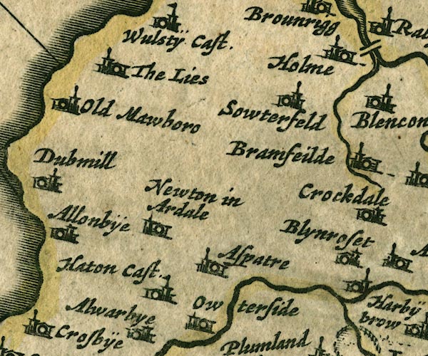
gazetteer links places may or may not be labelled on the map |
||

|
-- Aspatria -- "Aspatre" |
|
|
|
-- Blennerhasset -- "Blynroset" |
|
|
|
-- Bromfield -- "Bramfeilde" |
|
|
|
-- Hayton Castle -- "Haton Cast." |
|
|
|
-- Holme Coultram Abbey -- "Holme" |
|
|
|
-- Lowsay -- "The Lies" |
|
|
|
-- Mawbray -- "Old Mawboro" |
|
|
|
-- Oughterside -- "Owterside" |
|
|
|
-- Southerfield -- "Sowterfeld" |
|
|
|
-- Westnewton -- "Newton in Ardale" |
|
|
civil parishes The area roughly includes parts of parishes:- Blennerhasset and Torpenhow Allonby Bromfield Westnewton Hayton and Mealo Boltons Holme Abbey Holme Low Dundraw Bothel and Threapland Holme St Cuthbert Oughterside and Allerby Plumbland Aspatria Allhallows |
||
|
|
||
|
|
Lakes Guides menu. | |