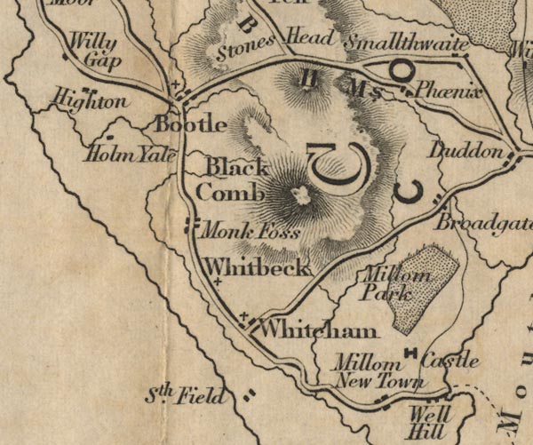
 Ford 1839 map SD18


|

|
|
|
gazetteer links places may or may not be labelled on the map |
||

|
-- Black Combe -- "Black Comb" |
|
|
|
-- Bootle -- "Bootle" |
|
|
|
-- Broadgate -- "Broadgate" |
|
|
|
-- Copeland -- "COPELAND" |
|
|
|
-- Fenwick -- "Phoenix" |
|
|
|
-- Holmegate -- "Holm Yale" |
|
|
|
-- Millom Castle -- "Castle" |
|
|
|
-- Millom Park -- "Millom Park" |
|
|
|
-- Millom -- "Millom New Town" |
|
|
|
-- Monk Foss Farm -- "Monk Foss" |
|
|
|
-- Broughton to Ravenglass -- "R to B 11 Ms." |
|
|
|
-- Southfield -- "Sth. Field" |
|
|
|
-- Well Hill -- "Well Hill" |
|
|
|
-- Whicham -- "Whitcham" |
|
|
|
-- Whitbeck -- "Whitbeck" |
|
|
civil parishes The area roughly includes parts of parishes:- Broughton West Millom Millom Without Ulpha Dunnerdale-with-Seathwaite Whicham Waberthwaite Bootle |
||
|
|
||
|
|
Lakes Guides menu. | |