 Ford 1839 map NY26


|

|
|
|
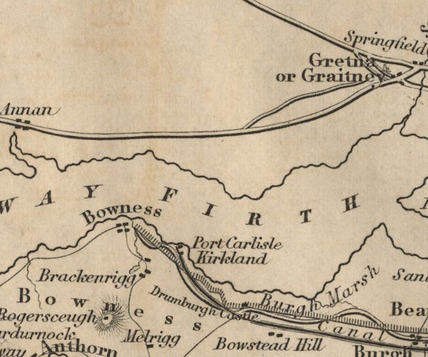
gazetteer links places may or may not be labelled on the map |
||

|
-- Bowness Common -- "Bowness" |
|
|
|
-- Bowness-on-Solway -- "Bowness" |
|
|
|
-- Brackenrigg -- "Brackenrigg" |
|
|
|
-- Burgh Marsh -- "Burgh Marsh" |
|
|
|
-- Carlisle Canal |
|
|
|
-- Drumburgh Castle -- "Drumburgh Castle" |
|
|
|
-- Hadrian's Wall |
|
|
|
-- Kirkland House -- "Kirkland" |
|
|
|
-- Port Carlisle -- "Port Carlisle" |
|
|
|
-- Rogersceugh -- "Rogersceugh" |
|
|
|
-- Solway Firth -- "SOLWAY FIRTH" |
|
|
civil parishes The area roughly includes parts of parishes:- Bowness Rockcliffe Burgh by Sands |
||
|
|
||
|
|
Lakes Guides menu. | |