 Ford 1839 map NY25


|

|
|
|
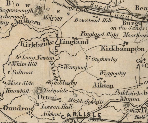
gazetteer links places may or may not be labelled on the map |
||

|
-- Aikton -- "Aikton" |
|
|
|
-- Boustead Hill -- "Bowstead Hill" |
|
|
|
-- Carlisle Canal |
|
|
|
-- Fingland Rigg -- "Fingland Rigg" |
|
|
|
-- Fingland -- "Fingland" |
|
|
|
-- Gamelsby -- "Gamblesby" |
|
|
|
-- Kirkbride -- "Kirkbride" |
|
|
|
-- Lessonhall -- "Lesson Hall" |
|
|
|
-- Low Whinnow -- "Whinna" |
|
|
|
-- Martin Tarn |
|
|
|
-- Micklethwaite -- "Micklethwaite" |
|
|
|
-- Millrigg -- "Melrigg" |
|
|
|
-- Oughterby -- "Oughterby" |
|
|
|
-- Oulton -- "Orton" |
|
|
|
-- Tarnside -- "Tarnside" |
|
|
|
-- Wampool -- "Wampool" |
|
|
|
-- Wampool, River -- "Wampool R." |
|
|
|
-- Wiggonby -- "Wiggonby" |
|
|
civil parishes The area roughly includes parts of parishes:- Rockcliffe Aikton Kirkbride Kirkbampton Burgh by Sands Thursby Waverton Woodside Holme East Waver Dundraw |
||
|
|
||
|
|
Lakes Guides menu. | |