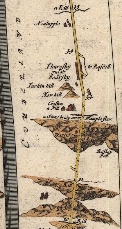
 Ogilby 1675, plate 96


|
|
|
|
|
gazetteer links places may or may not be labelled on the map |
||

|
-- (Crofton Bridge, Westward (OG96inc)) |
|
|
|
-- Croston -- (Crofton, Thursby (OG96inc)) |
|
|
|
-- How Hill -- (How Hill, Thursby (OG96inc)) |
|
|
|
-- (Howend, Thursby (OG96inc)) |
|
|
|
-- (Kirkland, Woodside (OG96inc)) |
|
|
|
-- (Nealhouse Beck (OG96inc)) |
|
|
|
-- Nealupple -- (Nealhouse, Thursby (OG96inc)) |
|
|
|
-- Rosdell -- (Rose Castle, Dalston (OG96inc)) |
|
|
|
-- Rosley Fell -- (Rosley Hill, Westward (OG96inc)) |
|
|
|
-- (Speet Gill (OG96inc)) |
|
|
|
-- Thuresby -- (Thursby (OG96inc)) |
|
|
|
-- Turkin Hill -- (Torkin Hill, Thursby (OG96inc)) |
|
|
|
-- Wample Fluvius -- (Wampool, River (OG96inc)) |
|
|
|
-- Warside -- (West Woodside, Westward (OG96inc)) |
|
|
civil parishes The route segment roughly includes parts of parishes:- Westward Thursby |
Lakes Guides menu.