 Old Cumbria Gazetteer
 |
 |
|
| Boat Crag, Buttermere | ||
| Boat Crag | ||
| locality:- | Whiteside End | |
| locality:- | Whiteside | |
| civil parish:- | Buttermere (formerly Cumberland) | |
| county:- | Cumbria | |
| locality type:- | rocks | |
| coordinates:- | NY16412178 (about) | |
| 1Km square:- | NY1621 | |
| 10Km square:- | NY12 | |
|
|
||
| evidence:- | old map:- OS County Series (Cmd 63 10) placename:- Boat Crag |
|
| source data:- | Maps, County Series maps of Great Britain, scales 6 and 25
inches to 1 mile, published by the Ordnance Survey, Southampton,
Hampshire, from about 1863 to 1948. |
|
|
|
||
| evidence:- | old map:- Gents Mag 1751 placename:- Boat Crag |
|
| source data:- | Map, uncoloured engraving, Map of the Black Lead Mines in
Cumberland, and area, scale about 2 miles to 1 inch, by George
Smith, published in the Gentleman's Magazine, 1751.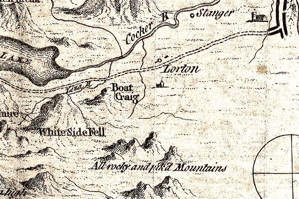 GM1307.jpg "Boat Crag" knobbly hillocks; mountains item:- JandMN : 114 Image © see bottom of page |
|
|
|
||
 Lakes Guides menu.