Old Cumbria Gazetteer
 |
 |
|
||
| Corby Beck | ||||
| runs into:- |  Stony Beck (2) Stony Beck (2) |
|||
|
|
||||
| locality:- | Great Corby | |||
| civil parish:- | Wetheral (formerly Cumberland) | |||
| county:- | Cumbria | |||
| locality type:- | river | |||
| locality type:- | flood | |||
| 1Km square:- | NY4854 | |||
| 10Km square:- | NY45 | |||
|
|
||||
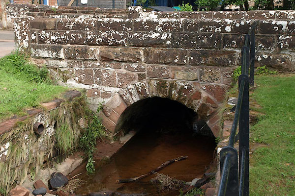
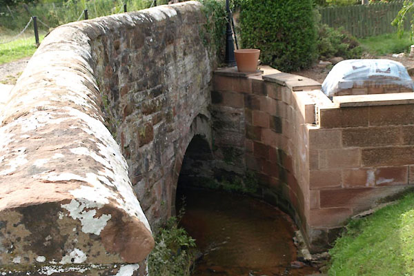
 BVA02.jpg Below the bridge, (taken 22.7.2011) 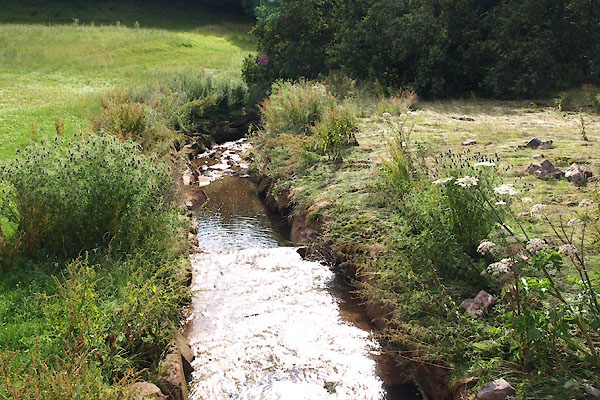 BVA08.jpg Below the bridge, (taken 22.7.2011) |
||||
| These two pictures show some of the flood damage caused by interference with the course
of the stream a few days earlier. The nearby houses had several feet of water in their
ground floor rooms. |
||||
|
|
||||
| evidence:- | old map:- OS County Series (Cmd 24 6) placename:- Corby Beck |
|||
| source data:- | Maps, County Series maps of Great Britain, scales 6 and 25
inches to 1 mile, published by the Ordnance Survey, Southampton,
Hampshire, from about 1863 to 1948. |
|||
|
|
||||
| places:- |
|
|||
|
||||
|
||||
|
||||
Lakes Guides menu.