 Old Cumbria Gazetteer
 |
 |
|
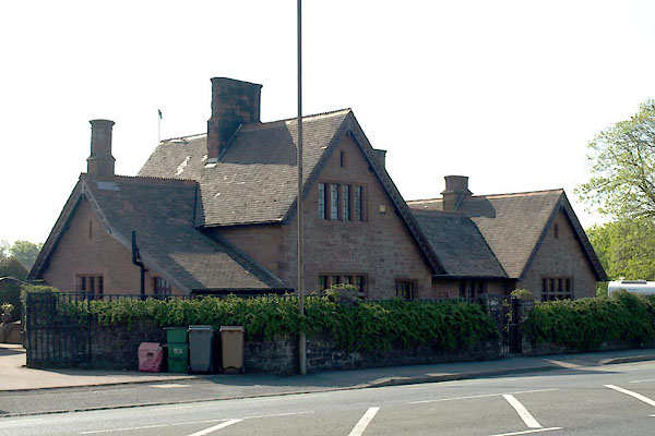
| Abbey Gate Cottages, Barrow-in-Furness | ||
| Abbey Gate Cottages | ||
| Street:- | Abbey Road | |
| civil parish:- | Barrow-in-Furness (formerly Lancashire) | |
| county:- | Cumbria | |
| locality type:- | buildings | |
| coordinates:- | SD21687226 | |
| 1Km square:- | SD2172 | |
| 10Km square:- | SD27 | |
| references:- | Listed Buildings 2010 |
|
|
|
||
 BWL81.jpg (taken 22.5.2012) |
||
|
|
||
| evidence:- | old map:- OS County Series (Lan 21 4) placename:- Abbey Gate Cottage |
|
| source data:- | Maps, County Series maps of Great Britain, scales 6 and 25
inches to 1 mile, published by the Ordnance Survey, Southampton,
Hampshire, from about 1863 to 1948. |
|
|
|
||
| evidence:- | database:- Listed Buildings 2010 placename:- Abbey Gate Cottages item:- date stone (1873) |
|
| source data:- | courtesy of English Heritage "ABBEY GATE COTTAGES / / ABBEY ROAD / BARROW IN FURNESS / BARROW IN FURNESS / CUMBRIA / II / 388379 / SD2168772263" |
|
|
|
||
 Lakes Guides menu.