 Old Cumbria Gazetteer
 |
 |
|
| Dubwath Bridge, Dubwath | ||
| Dubwath Bridge | ||
| site name:- | Dubwath Beck | |
| locality:- | Dubwath | |
| civil parish:- | Setmurthy (formerly Cumberland) | |
| civil parish:- | Wythop (formerly Cumberland) | |
| county:- | Cumbria | |
| locality type:- | bridge | |
| coordinates:- | NY19823115 | |
| 1Km square:- | NY1931 | |
| 10Km square:- | NY13 | |
|
|
||
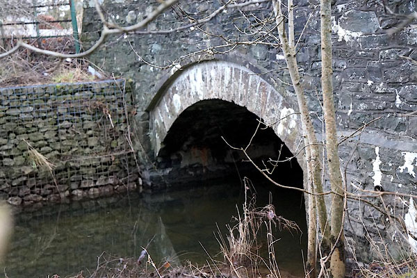 CCF06.jpg (taken 29.12.2014) 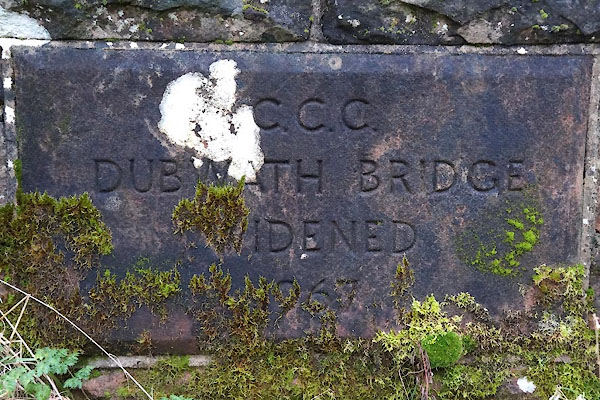 CCF07.jpg "C.C.C. / DUBWATH BRIDGE / WIDENED / 1967" (taken 29.12.2014) |
||
|
|
||
| evidence:- | old map:- OS County Series (Cmd 55 3) placename:- Dubwath Bridge |
|
| source data:- | Maps, County Series maps of Great Britain, scales 6 and 25
inches to 1 mile, published by the Ordnance Survey, Southampton,
Hampshire, from about 1863 to 1948. |
|
|
|
||
| evidence:- | old map:- Bell 1892 placename:- Pielwyke Bridge |
|
| source data:- | Map, colour lithograph, Road Map of Cumberland, by George Joseph
Bell, scale about 2.5 miles to 1 inch, printed by Charles
Thurnam and Sons, Carlisle, Cumberland, 1892. BEL9NY13.jpg "PIELWYKE" bridge symbol Road map of Cumberland showing County Bridges item:- Carlisle Library : Map 38 Image © Carlisle Library |
|
|
|
||
 Lakes Guides menu.