 Old Cumbria Gazetteer
 |
 |
|
| Workington Bridge, Workington | ||
| Workington Bridge | ||
| site name:- | Derwent, River | |
| locality:- | Workington | |
| civil parish:- | Workington (formerly Cumberland) | |
| county:- | Cumbria | |
| locality type:- | bridge | |
| coordinates:- | NY00782908 | |
| 1Km square:- | NY0029 | |
| 10Km square:- | NY02 | |
|
|
||
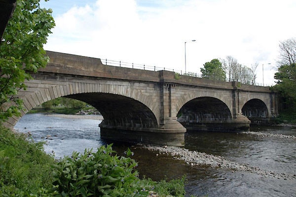 BUO06.jpg (taken 13.5.2011) 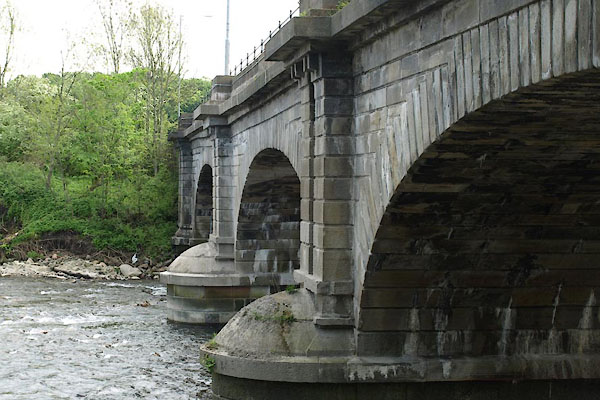 BUO07.jpg (taken 13.5.2011) |
||
|
|
||
| evidence:- | old map:- OS County Series (Cmd 53 7) placename:- Workington Bridge |
|
| source data:- | Maps, County Series maps of Great Britain, scales 6 and 25
inches to 1 mile, published by the Ordnance Survey, Southampton,
Hampshire, from about 1863 to 1948. |
|
|
|
||
| evidence:- | old map:- Badeslade 1742 placename:- |
|
| source data:- | Map, uncoloured engraving, A Map of Cumberland North from
London, scale about 11 miles to 1 inch, with descriptive text,
by Thomas Badeslade, London, engraved and published by William
Henry Toms, Union Court, Holborn, London, 1742. click to enlarge click to enlargeBD10.jpg "" double line across a stream item:- JandMN : 115 Image © see bottom of page |
|
|
|
||
| evidence:- | old map:- Bowen and Kitchin 1760 |
|
| source data:- | Map, hand coloured engraving, A New Map of the Counties of
Cumberland and Westmoreland Divided into their Respective Wards,
scale about 4 miles to 1 inch, by Emanuel Bowen and Thomas
Kitchin et al, published by T Bowles, Robert Sayer, and John
Bowles, London, 1760.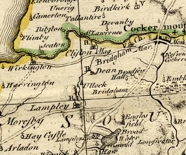 BO18NY02.jpg double line across the Derwent item:- Armitt Library : 2008.14.10 Image © see bottom of page |
|
|
|
||
| evidence:- | old map:- Donald 1774 (Cmd) |
|
| source data:- | Map, hand coloured engraving, 3x2 sheets, The County of Cumberland, scale about 1
inch to 1 mile, by Thomas Donald, engraved and published by Joseph Hodskinson, 29
Arundel Street, Strand, London, 1774.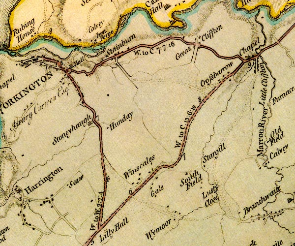 D4NY02NW.jpg double line across a river; a bridge item:- Carlisle Library : Map 2 Image © Carlisle Library |
|
|
|
||
| evidence:- | old map:- Bell 1892 placename:- Workington Bridge |
|
| source data:- | Map, colour lithograph, Road Map of Cumberland, by George Joseph
Bell, scale about 2.5 miles to 1 inch, printed by Charles
Thurnam and Sons, Carlisle, Cumberland, 1892. BEL9NY02.jpg "WORKINGTON" bridge symbol Road map of Cumberland showing County Bridges item:- Carlisle Library : Map 38 Image © Carlisle Library |
|
|
|
||
| evidence:- | database:- Listed Buildings 2010 placename:- Workington Bridge |
|
| source data:- | courtesy of English Heritage "WORKINGTON BRIDGE / / NORTHSIDE ROAD / WORKINGTON / ALLERDALE / CUMBRIA / II / 72281 / NY0077729075" |
|
| source data:- | courtesy of English Heritage "Roadbridge. Dated and inscribed on central parapet stones WORKINGTON BRIDGE, BUILT AD 1841, THOMAS MILTON CIVIL ENGINEER, THOMAS NELSON BUILDER (identical on each side). Calciferous sandstone ashlar. 3 segmental arches with rusticated voussoirs, on 2 round-ended piers. Solid parapet with chamfered coping on 3 paired pilasters. Cast iron parapet railings over northern arch. Later approach walling at either side and bridge over former railway are not of special interest." |
|
|
|
||
| evidence:- | old painting:- item:- sheep |
|
| source data:- | Painting, oil painting, Workington Bridge, over the River Derwent, Workington, Cumberland,
by Samuel Bough, 1842.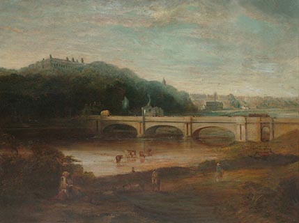 click to enlarge click to enlargePR0924.jpg A family group is seated in the foreground. Beside a wide river a small flock of sheep is being driven; cattle loiter in the shallows. Beyond the bridge rises a wooded hillside upon which stands Workington Hall; to right of composition lies a distant view of Workington. signed &dated at bottom left:- "Sam Bough 1842" item:- Tullie House Museum : 1936.4.3 Image © Tullie House Museum |
|
|
|
||
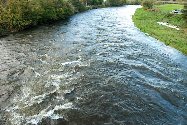 BPT60.jpg View of river. (taken 22.10.2008) |
||
|
|
||
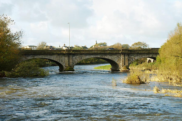 BPT58.jpg (taken 22.10.2008) 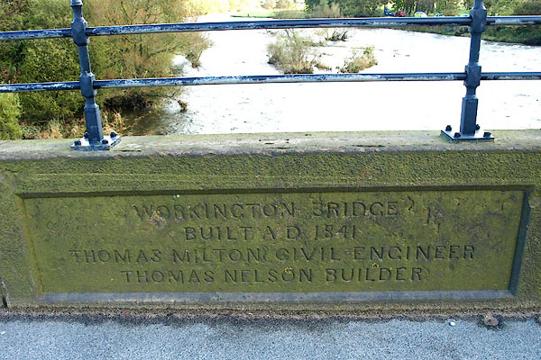 BPT59.jpg Plaque on east parapet:- "WORKINGTON BRIDGE / BUILT A.D. 1841. / THOMAS MILTON CIVIL ENGINEER. / THOMAS NELSON BUILDER." (taken 22.10.2008) |
||
|
|
||
| notes:- |
Damaged by the floods, 2009. |
|
|
|
||
 Lakes Guides menu.