 Old Cumbria Gazetteer
 |
 |
|
| Thrang Bridge, Mallerstang | ||
| Thrang Bridge | ||
| site name:- | Eden, River | |
| locality:- | Mallerstang | |
| civil parish:- | Mallerstang (formerly Westmorland) | |
| county:- | Cumbria | |
| locality type:- | footbridge | |
| locality type:- | bridge | |
| coordinates:- | NY78200049 | |
| 1Km square:- | NY7800 | |
| 10Km square:- | NY70 | |
|
|
||
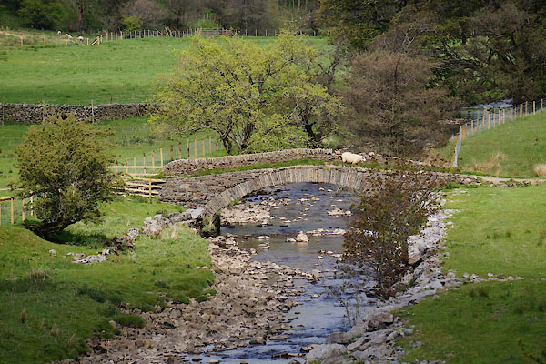 CDC42.jpg (taken 26.5.2015) |
||
|
|
||
| evidence:- | old map:- OS County Series (Wmd 36 3) placename:- Thrang Bridge |
|
| source data:- | Maps, County Series maps of Great Britain, scales 6 and 25
inches to 1 mile, published by the Ordnance Survey, Southampton,
Hampshire, from about 1863 to 1948. |
|
|
|
||
 Lakes Guides menu.