 Old Cumbria Gazetteer
 |
 |
|
| Longthwaite Bridge, Borrowdale | ||
| Longthwaite Bridge | ||
| site name:- | Derwent, River (?) | |
| locality:- | Longthwaite | |
| civil parish:- | Borrowdale (formerly Cumberland) | |
| county:- | Cumbria | |
| locality type:- | bridge | |
| coordinates:- | NY25571434 | |
| 1Km square:- | NY2514 | |
| 10Km square:- | NY21 | |
|
|
||
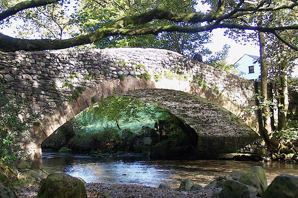 BOF89.jpg (taken 5.10.2007) |
||
|
|
||
| evidence:- | old print:- Green 1814 (plate 36) placename:- Langthwaite Bridge |
|
| source data:- | Print, tinted soft ground etching, Langthwaite Bridge, Borrowdale, Cumberland, by
William Green, Ambleside, Westmorland, 1814.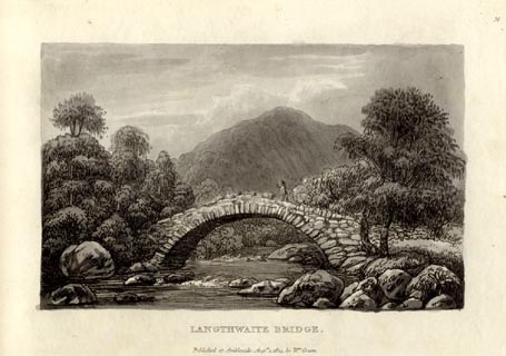 click to enlarge click to enlargeGN1036.jpg Plate 36 in Sixty Small Prints. printed at top right:- "36" printed at bottom:- "LANGTHWAITE BRIDGE. / Published at Ambleside Augst. 1, 1814, by Wm. Green." item:- Armitt Library : A6653.36 Image © see bottom of page |
|
|
|
||
| evidence:- | old print:- Green 1814 (plate 36) placename:- Langthwaite Bridge |
|
| source data:- | Print, uncoloured soft ground etching, Langthwaite Bridge, Borrowdale, Cumberland,
by William Green, Ambleside, Westmorland, 1814.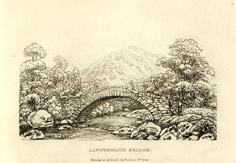 click to enlarge click to enlargeGN0936.jpg Plate 36 in Sixty Small Prints. printed at top right:- "36" printed at bottom:- "LANGTHWAITE BRIDGE. / Published at Ambleside Augst. 1, 1814, by Wm. Green." item:- Armitt Library : A6656.36 Image © see bottom of page |
|
|
|
||
| evidence:- | old text:- Green 1814 placename:- Langthwaite Bridge |
|
| source data:- | Set of prints, soft ground etchings, Sixty Small Prints, with
text, A Description of a Series of Sixty Small Prints, by
William Green, Ambleside, Westmorland, 1814. goto source goto sourcepage 20:- "..." "LANGTHWAITE BRIDGE." "The source of the stream passing under this bridge [plate 36] is in Sprinkling Tarn, which descending the mountain Sprinkling, unites itself with Sty Head Tarn, and having reached the valley, winds between the village of Seathwaite and the black lead mines to Langthwaite Bridge, which is a quarter of a mile from Rosthwaite." |
|
|
|
||
Lakes Guides menu.