 Old Cumbria Gazetteer
 |
 |
|
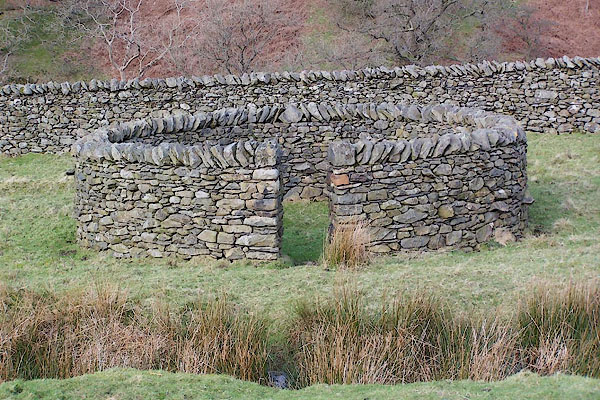
| Jack's Fold, Barbondale | ||
| Jack's Fold | ||
| locality:- | Barbondale | |
| civil parish:- | Barbon (formerly Westmorland) | |
| county:- | Cumbria | |
| locality type:- | sheepfold | |
| coordinates:- | SD64768259 | |
| 1Km square:- | SD6482 | |
| 10Km square:- | SD68 | |
|
|
||
 BNH47.jpg (taken 2.3.2007) 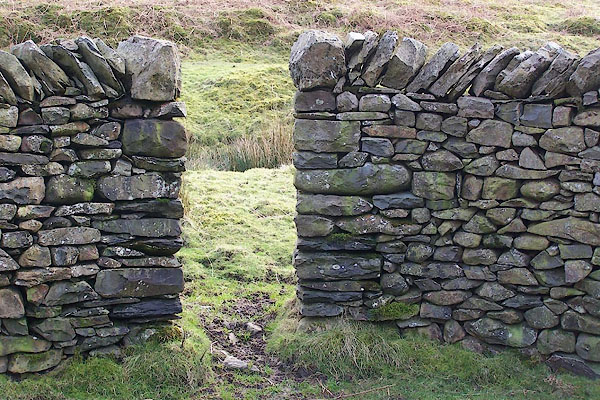 BNH48.jpg (taken 2.3.2007) |
||
|
|
||
| evidence:- | old map:- OS County Series (Wmd 44 13) |
|
| source data:- | Maps, County Series maps of Great Britain, scales 6 and 25
inches to 1 mile, published by the Ordnance Survey, Southampton,
Hampshire, from about 1863 to 1948. "Sheepfold" |
|
|
|
||
| :- |
Renewed by Andy Goldsworthy as part of the Sheepfolds project, 1996-2002. |
|
| This fold was displayed at a gallery in St Albans before being erected here. |
||
| : 2002 (?): Andy Goldsworthy Sheepfolds: Cumbria CC (?):: leaflet from TIC www.sheepfolds.org |
||
|
|
||
 Lakes Guides menu.