 Old Cumbria Gazetteer
 |
 |
|
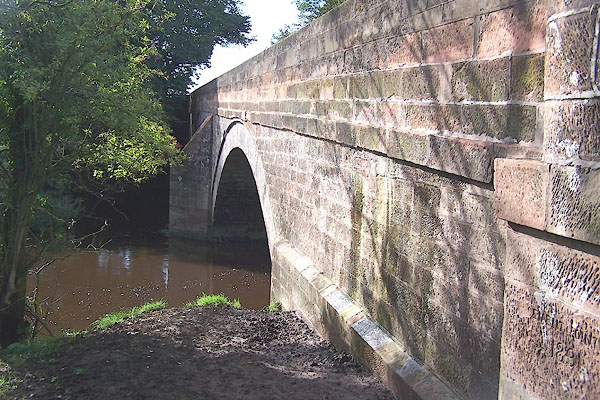
| Westlinton Bridge, Westlinton | ||
| Westlinton Bridge | ||
| site name:- | Lyne, River | |
| locality:- | Westlinton | |
| civil parish:- | Westlinton (formerly Cumberland) | |
| civil parish:- | Arthuret (formerly Cumberland) | |
| county:- | Cumbria | |
| locality type:- | bridge | |
| locality type:- | boundary mark | |
| locality type:- | parish boundary mark | |
| coordinates:- | NY39286465 | |
| 1Km square:- | NY3964 | |
| 10Km square:- | NY36 | |
|
|
||
 BMP93.jpg (taken 15.9.2006) 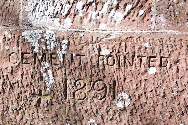 BMP94.jpg On the east face:- "CEMENT POINTED 1891" (taken 15.9.2006) |
||
|
|
||
| evidence:- | old map:- OS County Series (Cmd 10 15) placename:- Westlinton Bridge |
|
| source data:- | Maps, County Series maps of Great Britain, scales 6 and 25
inches to 1 mile, published by the Ordnance Survey, Southampton,
Hampshire, from about 1863 to 1948. |
|
|
|
||
| evidence:- | old map:- Donald 1774 (Cmd) |
|
| source data:- | Map, hand coloured engraving, 3x2 sheets, The County of Cumberland, scale about 1
inch to 1 mile, by Thomas Donald, engraved and published by Joseph Hodskinson, 29
Arundel Street, Strand, London, 1774.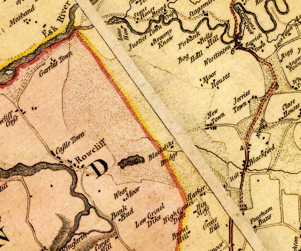 D4NY36SE.jpg double line across a river; a bridge at Westlinton item:- Carlisle Library : Map 2 Image © Carlisle Library |
|
|
|
||
| evidence:- | old map:- Bell 1892 placename:- Westlinton Bridge |
|
| source data:- | Map, colour lithograph, Road Map of Cumberland, by George Joseph
Bell, scale about 2.5 miles to 1 inch, printed by Charles
Thurnam and Sons, Carlisle, Cumberland, 1892.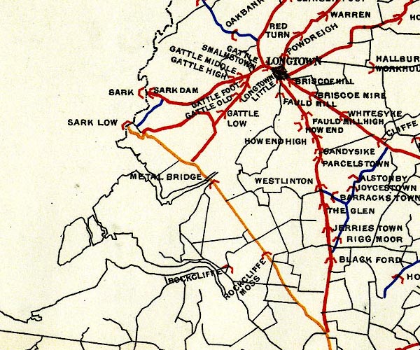 BEL9NY36.jpg "WESTLINTON" bridge symbol Road map of Cumberland showing County Bridges item:- Carlisle Library : Map 38 Image © Carlisle Library |
|
|
|
||
| evidence:- | database:- Listed Buildings 2010 placename:- Westlington Bridge |
|
| source data:- | courtesy of English Heritage "WESTLINGTON BRIDGE / / / WESTLINTON / CARLISLE / CUMBRIA / II / 77981 / NY3928764644" |
|
| source data:- | courtesy of English Heritage "Road bridge. Probably 1793 for the Carlisle-Longtown Turnpike. Red sandstone ashlar. 2 segmental arches with central pier having pointed cutwaters. Abutments have chamfered plinth and cylinderical end piers. String course with chamfered coped parapet. Abutment inscription CEMENT POINTED 1891. This bridge is partly in Arthuret CP." |
|
|
|
||
 BMP95.jpg Access steps, NE pier. (taken 15.9.2006) |
||
|
|
||
 Lakes Guides menu.