 Old Cumbria Gazetteer
 |
 |
|
| Troutbeck Station, Troutbeck | ||
| Troutbeck Station | ||
| Station House | ||
| site name:- | Cockermouth, Keswick and Penrith Railway | |
| locality:- | Troutbeck | |
| locality:- | Hutton Moor | |
| civil parish:- | Hutton (formerly Cumberland) | |
| county:- | Cumbria | |
| locality type:- | railway station | |
| coordinates:- | NY38992707 | |
| 1Km square:- | NY3827 | |
| 10Km square:- | NY32 | |
| SummaryText:- | Opened 1865; closed 1972. | |
|
|
||
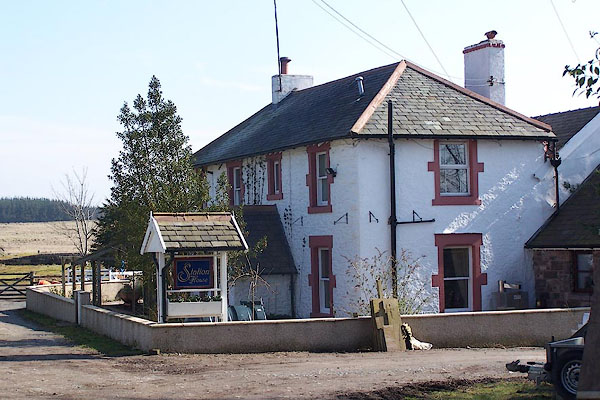 BNK46.jpg (taken 24.3.2007) |
||
|
|
||
| evidence:- | old map:- OS County Series (Cmd 57 11) placename:- Troutbeck Station item:- railway signal; weighing machine; crane |
|
| source data:- | Maps, County Series maps of Great Britain, scales 6 and 25
inches to 1 mile, published by the Ordnance Survey, Southampton,
Hampshire, from about 1863 to 1948.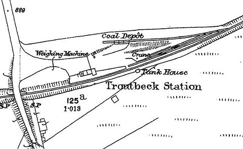 click to enlarge click to enlargeCSRY0078.jpg "Troutbeck Station / Coal Depot / S.P. / Weighing Machine / Crane / Tank House" |
|
|
|
||
| evidence:- | old map:- Postlethwaite 1877 (3rd edn 1913) |
|
| source data:- | Map, uncoloured engraving, Map of the Lake District Mining Field, Westmorland, Cumberland,
Lancashire, scale about 5 miles to 1 inch, by John Postlethwaite, published by W H
Moss and Sons, 13 Lowther Street, Whitehaven, Cumberland, 1877 edn 1913.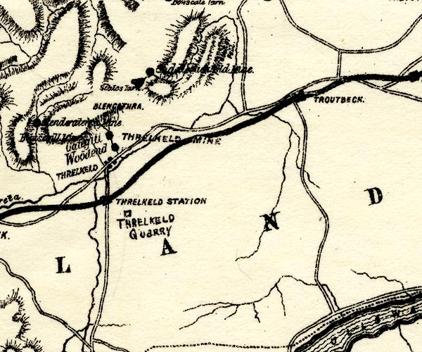 PST2NY32.jpg "TROUTBECK" station on railway item:- JandMN : 162.2 Image © see bottom of page |
|
|
|
||
| evidence:- | old map:- Post Office 1850s-1900s placename:- Troutbeck Station |
|
| source data:- | Post road maps, General Post Office Circulation Map for England
and Wales, for the General Post Office, London, 1850s-1900s. click to enlarge click to enlargePF10Cm.jpg "Troutbeck Sta." map date 1892 |
|
|
|
||
| evidence:- | old map:- Post Office 1850s-1900s placename:- Troutbeck Station |
|
| source data:- | Post road maps, General Post Office Circulation Map for England
and Wales, for the General Post Office, London, 1850s-1900s. click to enlarge click to enlargePOF2Cm.jpg "Troutbeck Sta." map date 1890 |
|
|
|
||
| :- |
images courtesy of the British Postal Museum and Hampshire CC Museums |
|
|
|
||
 Lakes Guides menu.