 Old Cumbria Gazetteer
 |
 |
|
| New House, Lorton | ||
| New House | ||
| civil parish:- | Lorton (formerly Cumberland) | |
| county:- | Cumbria | |
| locality type:- | buildings | |
| coordinates:- | NY15622395 | |
| 1Km square:- | NY1523 | |
| 10Km square:- | NY12 | |
|
|
||
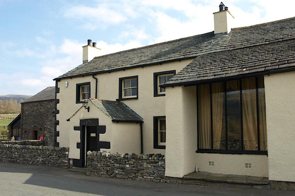 BUG73.jpg (taken 28.3.2011) 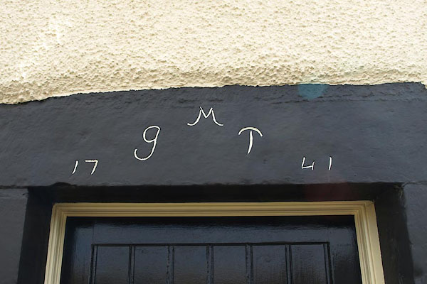 BUG74.jpg Date stone:- "M / G T / 17 41" (taken 28.3.2011) |
||
|
|
||
| evidence:- | old map:- OS County Series (Cmd 63 1) placename:- New House placename:- House, New |
|
| source data:- | Maps, County Series maps of Great Britain, scales 6 and 25
inches to 1 mile, published by the Ordnance Survey, Southampton,
Hampshire, from about 1863 to 1948. |
|
|
|
||
| evidence:- | old map:- Donald 1774 (Cmd) placename:- New House |
|
| source data:- | Map, hand coloured engraving, 3x2 sheets, The County of Cumberland, scale about 1
inch to 1 mile, by Thomas Donald, engraved and published by Joseph Hodskinson, 29
Arundel Street, Strand, London, 1774.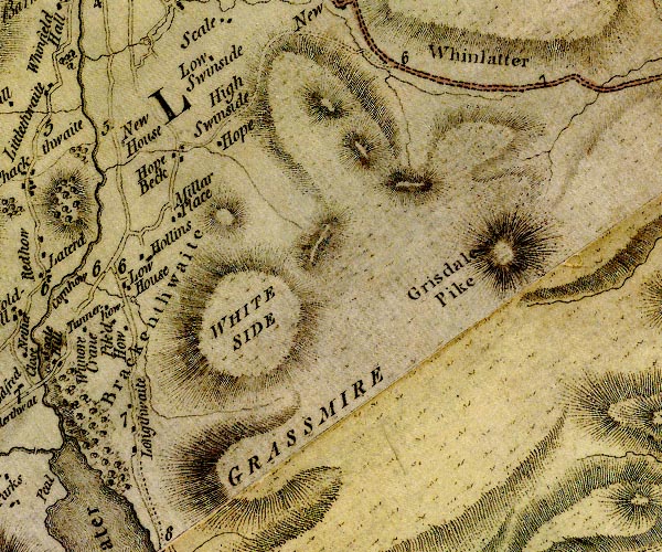 D4NY12SE.jpg "New House" block or blocks, labelled in lowercase; a hamlet or just a house item:- Carlisle Library : Map 2 Image © Carlisle Library |
|
|
|
||
| evidence:- | database:- Listed Buildings 2010 placename:- New Farm item:- date stone (1741) |
|
| source data:- | courtesy of English Heritage "NEW FARMHOUSE AND BARN ADJOINING / / / LORTON / ALLERDALE / CUMBRIA / II / 72667 / NY1563123953" |
|
|
|
||
 Lakes Guides menu.