 Old Cumbria Gazetteer
 |
 |
|
| Mere Gill | ||
| county:- | North Yorkshire | |
| locality type:- | river | |
| 1Km square:- | SD7475 | |
| 10Km square:- | SD77 | |
|
|
||
| evidence:- | descriptive text:- Balderston c1890 |
|
| source data:- | Book, Ingleton, Bygone and Present, by Robert R and Margaret
Balderston, published by Simpkin, Marshall and Co, London, and
by Edmndson and Co, 24 High Street, Skipton, Yorkshire, about
1890. goto source goto sourcepage 43:- "..." "Some distance further along the flats [of Ingleborough] to the south-west, and in a position intermediate between God's Bridge and the spur of Ingleborough, called Swine's Tail, is a rapid mountain stream, by the sides of which various ferns grow in great abundance; its extent, however, upon the moorland" goto sourcepage 44:- "is not very great, for its course is suddenly intercepted by a tremendous canyon [Mere Gill Hole] ..." |
|
|
|
||
| evidence:- | old map:- Balderston c1890 map |
|
| source data:- | Map, the hills in the Ingleton area, probably by Robert R
Balderston, engraved by Goodall and Suddick, Leeds, West
Yorkshire, about 1890.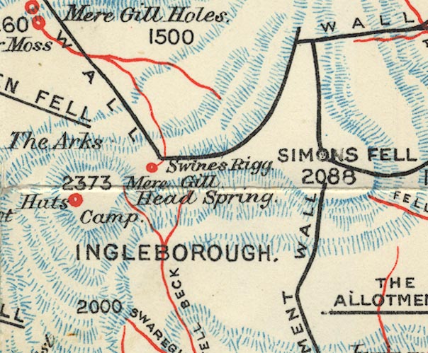 BS1SD77M.jpg "Mere Gill Head Spring" item:- private collection : 27.1 Image © see bottom of page |
|
|
|
||
Lakes Guides menu.