 Old Cumbria Gazetteer
 |
 |
|
| Myers Head Mine, Hartsop | ||
| Myers Head Mine | ||
| Low Hartsop Mine | ||
| locality:- | Hartsop | |
| civil parish:- | Patterdale (formerly Westmorland) | |
| county:- | Cumbria | |
| locality type:- | lead mine | |
| locality type:- | mine | |
| coordinates:- | NY41561265 (etc) | |
| 1Km square:- | NY4112 | |
| 10Km square:- | NY41 | |
| references:- | Adams, John: 1988: Mines of the Lake District Fells: Dalesman Books (Lancaster, Lancashire)::
ISBN 0 85206 931 6 |
|
|
|
||
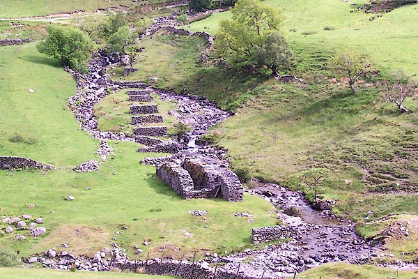 BQS88.jpg Structures, (taken 9.6.2009) 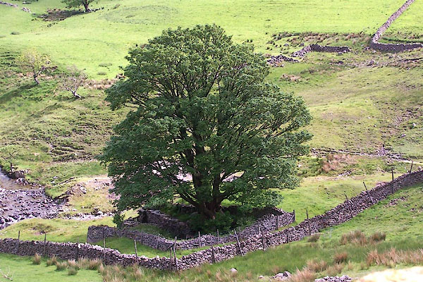 BQS89.jpg Structures, (taken 9.6.2009) |
||
|
|
||
| evidence:- | old text:- Postlethwaite 1877 (3rd edn 1913) placename:- Myer Head Mine item:- lead ore |
|
| source data:- | Book, Mines and Mining in the English Lake District, by John Postlethwaite, Keswick,
published by W H Moss and Sons, Whitehaven, Cumberland now Cumbria, 1877; published
1877-1913. goto source goto sourcepage 127:- "MYER HEAD, HARTSOP HALL, AND EAGLE CRAG MINES." "These mines are situated in glens, which branch off from the Patterdale Valley. Myer Head, at the entrance to Threshthwaite Mouth Glen; ... They have been wrought chiefly by means of adit levels, which pierce the sides of the mountains at various elevations. Extensive excavations have been made above and between these levels and considerable quantities of lead ore raised. A shaft has also been sunk at Myer Head 30 fathoms deep." |
|
|
|
||
| evidence:- | old map:- Postlethwaite 1877 (3rd edn 1913) placename:- Myer Head Mine |
|
| source data:- | Map, uncoloured engraving, Map of the Lake District Mining Field, Westmorland, Cumberland,
Lancashire, scale about 5 miles to 1 inch, by John Postlethwaite, published by W H
Moss and Sons, 13 Lowther Street, Whitehaven, Cumberland, 1877 edn 1913.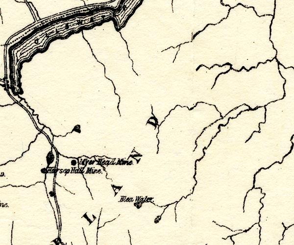 PST2NY41.jpg "Myer Head Mine" mine symbol item:- JandMN : 162.2 Image © see bottom of page |
|
|
|
||
| evidence:- | probably visit log:- KDMRS 1979-82 placename:- Myre Head Mines item:- pyromorphite; galena; blende; copper ore; quartz |
|
| source data:- | Notes, log book of Geological Outings, mine plans, etc, Kendal
and District Mine Research Society, Kendal area, Cumbria, etc,
visits made 1979-82. Geological Outing of the Kendal and District Mine Research Society Log book page 26:- "DATE - SUNDAY 5/8/79 / MAP REF - 4121/1285///4166/1255/ LOCATION - MYRE HEAD / NAME - MYRE HEAD MINES / TYPE OF SITE - MINES / WORKING OR DISUSED - DISUSED. / PEOPLE IN PARTY [ ] / NOS. OF PHOTOS - 18 / SPECIMENS FOUND - PYROMORPHITE GALENA AND BLENDE WITH SOME SMALL AMOUNTS OF COPPER / COMMENTS - RAIN, DAM'N WET! SPOIL HEAPS AND LEVELS STILL VISIBLE, ALTHOUGH ONLY ONE LEVEL IS (MAP REF 4121/1285) STILL OPEN AND ENTERABLE, THIS LEVEL WILL BE EXPLORED AT SOME LATER DATE. THE OTHER TWO LEVELS HIGHER UP THE VALLEY HAVE COLLAPSED AFTER A FEW YARDS." Log book page 38:- "DATE - 14/10/79 / MAP REF - 4100/1265 / LOCATION - MYRE HEAD / NAME - MYRE HEAD MINES / TYPE OF SITE - MINE SHAFT/LEVEL / WORKING OR DISUSED - DISUSED / PEOPLE IN PARTY [ ] / NOS. OF PHOTOS - 18 / SPECIMENS FOUND - GALENA (IN SMALL PIECES) AND QUARTZ CRYSTALS / COMMENTS - ENTERED TOP LEVEL FOR A FEW YARDS AND CAME TO A DEEP SHAFT GOING DOWN TO BOTTOM LEVEL. SKETCH SHOWS LEVELS ETC IN MORE DETAIL. [sketch]" item:- private collection : 82 Image © see bottom of page |
|
|
|
||
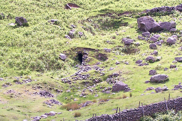 BQS90.jpg Adit, (taken 9.6.2009) |
||
|
|
||
| :- |
At the meet of Pasture Beck and Hayeswater Gill. Worked from about 1867 to about 1878;
a commercial failure. |
|
| Argentiferous galena, blende, and a little copper pyrite. |
||
| Adams, John: 1988: Mines of the Lake District Fells: Dalesman Books (Lancaster, Lancashire)::
ISBN 0 85206 931 6 |
||
|
|
||
Lakes Guides menu.