 Saxton 1576 SD39


|

|
|
|
gazetteer links places may or may not be labelled on the map |
||

|
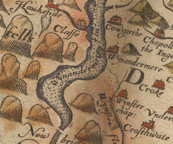
-- Calgarth Hall -- "Cowgarthe" |
|
|
|
-- Claife -- "Claffe" |
|
|
|
-- Cunsey Beck |
|
|
|
-- Esthwaite Water |
|
|
|
-- Windermere -- "Wynandermere" |
|
|
|
-- Windermere lake -- "Wynandermere flu:" |
|
|
|
-- Winster -- "Wynster chap:" |
|
|
|
-- Winster, River -- "Wynster flu:" |
|
|
civil parishes The area roughly includes parts of parishes:- Torver Satterthwaite Claife Lakes Colton Windermere Hawkshead Cartmel Fell Coniston |
||
|
|
||
|
|
Lakes Guides menu. | |