 Otley 1818 SD48


|

|
|
|
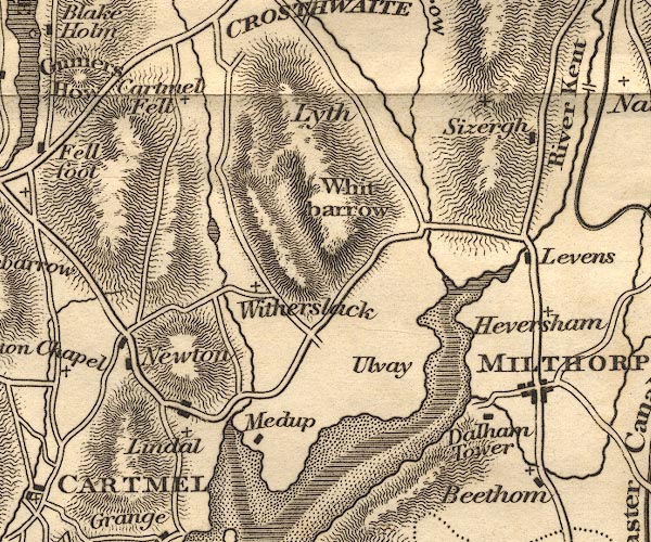
gazetteer links places may or may not be labelled on the map |
||

|
-- Beetham |
|
|
|
-- Cartmel Fell |
|
|
|
-- Dallam Tower |
|
|
|
-- Gilpin, River |
|
|
|
-- Helton Tarn |
|
|
|
-- Heversham |
|
|
|
-- Levens Bridge |
|
|
|
-- Levens Hall |
|
|
|
-- Lindale |
|
|
|
-- Lyth Valley |
|
|
|
-- Meathop |
|
|
|
-- Milnthorpe -- "MILTHORP" |
|
|
|
-- Newton Fell |
|
|
|
-- Sizergh Castle |
|
|
|
-- Ulpha |
|
|
|
-- Whitbarrow |
|
|
|
-- Winster, River |
|
|
|
-- Witherslack |
|
|
civil parishes The area roughly includes parts of parishes:- Broughton East Staveley-in-Cartmel Underbarrow and Bradleyfield Heversham Witherslack Beetham Meathop and Ulpha Milnthorpe Cartmel Fell Crosthwaite and Lyth Levens Helsington Upper Allithwaite Grange-over-Sands |
||
|
|
||
|
|
Lakes Guides menu. | |