 A Survey of the Lakes of Cumberland, Westmorland, and Lancashire

|

|
|
|
map type:- Clarke 1787 map |
|
|
|
Maps, series issued in a guide book, A Survey of the
Lakes of Cumberland, Westmorland, and Lancashire, by James
Clarke, Penrith, Cumberland, engraved by S J Neele, 352
Strand, London, published 1787-89; and in Plans of the Lakes
... 1793.
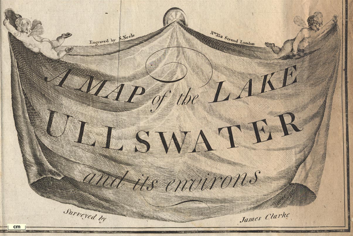
The maps are:- plate 1. A Map of the Town of Penrith and Country Adjacent. plate 2. A Map of the Town of Penrith in the County of Cumberland. plate 3. A Map of the Roads between Penrith and Ullswater, scale about 10 ins to 1 mile; shows the River Eamont from Pooley Bridge for about 4 miles NE towards Penrith, and the country and roads either side. plate 4. A Map of the Lake Ullswater and its Environs, scale about 6.5 ins to 1 mile. plate 5. A Map of the Roads, Waters &c between Penrith and Keswick, scale about 2 ins to 1 mile; shows the road from about Stainton to beyond Threlkeld. plate 6. A Map of Derwentwater and its Environs. plate 7. A Map of the Roads etc. between Keswick and Broadwater. plate 8. A Map of Broadwater and its Environs, ie Bassenthwaite Lake, scale about 6.5 ins to 1 mile. plate 9. A Map of the Roads Lakes &c between Keswick and Ambleside, scale about 2.5 ins to 1 mile; shows the road from about Castlerigg to the edge of Ambleside, past Thirlmere Lake, Grasmere water, and Rydal Water. plate 10. A Map of the Northern Part of the Lake Winandermere and its Environs, scale about 6.5 ins to 1 mile. plate 11. A Map of the Southern Part of the Lake Winandermere and its Environs, scale about 6.5 ins to 1 mile. |
||
|
||
| sources:- |
Bicknell 1990 private collection JandMN Collection |
|
| items seen (illustrated items in bold, * have map squares etc):- | ||

|
Armitt Library : A6615.2 -- street map -- Map of the Town of Penrith in the County of Cumberland | |
|
|
Armitt Library : A6615.7 -- map -- Map of the Roads etc between Keswick, and Broadwater | |
|
|
JandMN (56) -- map -- Map of the Lake Ullswater and its Environs | |
|
|
private collection (10_3) -- map -- Map of the Roads between Penrith and Ullswater | |
|
|
private collection (10_4) -- map -- Map of the Lake Ullswater and its Environs * | |
|
|
private collection (10_5) -- map -- Map of the Roads, Waters etc between Penrith and Keswick | |
|
|
private collection (10_8) -- map -- Map of Broadwater and its Environs * | |
|
|
private collection (10_9) -- map -- Map of the Roads Lakes etc between Keswick and Ambleside * | |
|
|
private collection (10_10) -- map -- Map of the Northern Part of the Lake Winandermere and its Environs * | |
|
|
private collection (10_11) -- map -- Map of the Southern Part of the Lake Winandermere and its Environs * | |
|
|
private collection (26) -- map -- Map of the Town of Penrith and Country Adjacent | |
|
|
private collection (169) -- map -- Map of Derwentwater and its Environs * | |
|
|
private collection (292) -- map -- Map of the Lake Ullswater and its Environs | |
|
|
private collection (293) -- map -- Map of the Roads, Waters etc between Penrith and Keswick | |
|
|
private collection (294) -- map -- Map of Broadwater and its Environs | |
|
|
private collection (295) -- map -- Map of the Northern Part of the Lake Winandermere and its Environs | |
|
|
private collection (296) -- map -- Map of the Southern Part of the Lake Winandermere and its Environs | |