 Simpson 1746 map

|

|
|
|
item:- Dove Cottage : 2007.38.59 image:- © see bottom of page |
click to enlarge |
|
|
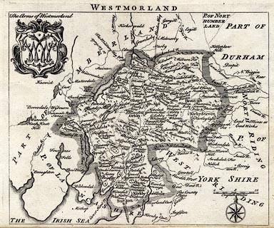
Map, uncoloured engraving, Westmorland, scale about 8
miles to 1 inch, printed by R Walker, Fleet Lane, London,
1746.
From The Agreeable Historian by Samuel Simpson; the book's title page states '... With a Map of every County pre- / fix'd to each, from the best and latest Observations, after / the Designs of HERMAN MOLL, and others. ...'; the map has much the same detail as the map by Moll 1724. |
||

|
Simpson 1746 map | |
| map feature:- | coat of arms (spurious) & compass rose & up is N & scale line & sea plain & coast form lines & rivers & lakes & relief & hillocks & woods & parks & county & settlements & roads & road distances | |
| inscription:- |
printed top
WESTMORLAND |
|
| scale line:- | 10 miles = 32.3 mm | |
| scale:- | 1 to 500000 ? (1 to 498249 from scale line wrongly assuming a statute mile) | |
| wxh, sheet:- | 20.5x17cm | |
| wxh, map:- | 189x154mm | |
|
|
notes | |