 Old Cumbria Gazetteer
 |
 |
|
| Askew Rigg, Mungrisdale | ||
| Askew Rigg | ||
| Haskew Rigg | ||
| civil parish:- | Mungrisdale (formerly Cumberland) | |
| county:- | Cumbria | |
| locality type:- | buildings | |
| coordinates:- | NY37112794 | |
| 1Km square:- | NY3727 | |
| 10Km square:- | NY32 | |
| SummaryText:- | Incorrectly named on the OS Admin Areas diagram? | |
| references:- | Listed Buildings 2010 |
|
|
|
||
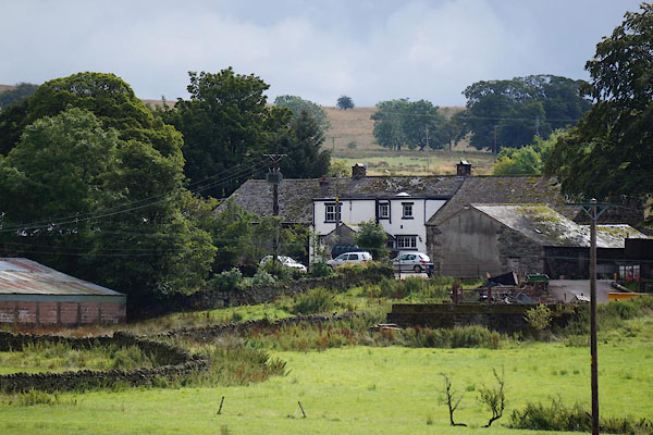 CBJ58.jpg (taken 15.8.2014) |
||
|
|
||
| evidence:- | old map:- OS County Series (Cmd 57 10) placename:- Askewrigg |
|
| source data:- | Maps, County Series maps of Great Britain, scales 6 and 25
inches to 1 mile, published by the Ordnance Survey, Southampton,
Hampshire, from about 1863 to 1948. |
|
|
|
||
| evidence:- | old map:- Donald 1774 (Cmd) placename:- Askew |
|
| source data:- | Map, hand coloured engraving, 3x2 sheets, The County of Cumberland, scale about 1
inch to 1 mile, by Thomas Donald, engraved and published by Joseph Hodskinson, 29
Arundel Street, Strand, London, 1774.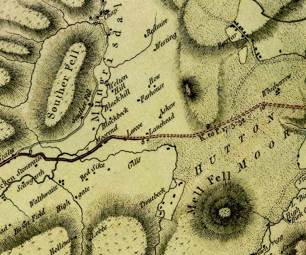 D4NY32NE.jpg "Askew" block or blocks, labelled in lowercase; a hamlet or just a house item:- Carlisle Library : Map 2 Image © Carlisle Library |
|
|
|
||
| evidence:- | database:- Listed Buildings 2010 placename:- Askew Rigg |
|
| source data:- | courtesy of English Heritage "ASKEW RIGG / / / MUNGRISDALE / EDEN / CUMBRIA / II / 73522 / NY3711827945" |
|
|
|
||
 Lakes Guides menu.