 Old Cumbria Gazetteer
 |
 |
|
| Lowpark, Loweswater | ||
| Lowpark | ||
| locality:- | Parks | |
| locality:- | Loweswater | |
| civil parish:- | Loweswater (formerly Cumberland) | |
| county:- | Cumbria | |
| locality type:- | buildings | |
| coordinates:- | NY14422041 (etc) | |
| 1Km square:- | NY1420 | |
| 10Km square:- | NY12 | |
| SummaryText:- | The group of buildings is treated as one | |
| SummaryText:- | The positions of Highpark and Lowpark relative to the Park Beck are interesting. | |
|
|
||
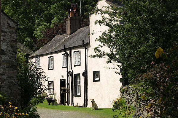 BVF02.jpg (taken 17.8.2011) 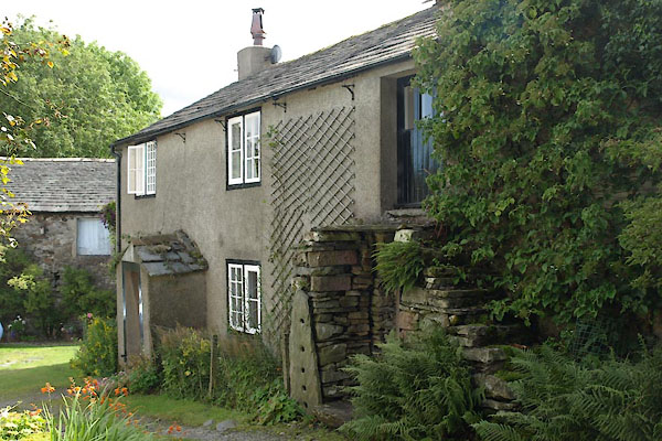 BVF05.jpg (taken 17.8.2011) |
||
|
|
||
| evidence:- | old map:- Donald 1774 (Cmd) placename:- Parks |
|
| source data:- | Map, hand coloured engraving, 3x2 sheets, The County of Cumberland, scale about 1
inch to 1 mile, by Thomas Donald, engraved and published by Joseph Hodskinson, 29
Arundel Street, Strand, London, 1774.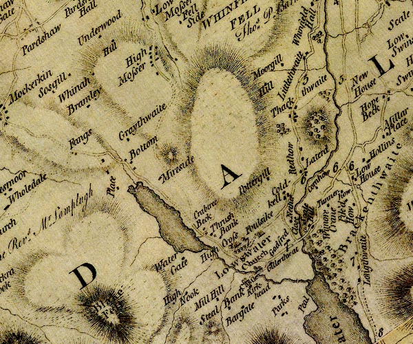 D4NY12SW.jpg "Parks" block or blocks, labelled in lowercase; a hamlet or just a house item:- Carlisle Library : Map 2 Image © Carlisle Library |
|
|
|
||
| evidence:- | possibly descriptive text:- West 1778 (11th edn 1821) |
|
| source data:- | Guide book, A Guide to the Lakes, by Thomas West, published by
William Pennington, Kendal, Cumbria once Westmorland, and in
London, 1778 to 1821. goto source goto sourcePage 140:- "... The south end [of Loweswater] is overlooked by lofty Mellbreak, at whose foot, a white house within some grass inclosures, under a few trees, stands in the point of beauty." |
|
|
|
||
| evidence:- | old map:- Crosthwaite 1783-94 (But/Cru/Low) placename:- Low Park |
|
| source data:- | Map, uncoloured engraving, An Accurate Map of Buttermere,
Crummock and Loweswater Lakes, scale about 3 inches to 1 mile,
by Peter Crosthwaite, Keswick, Cumberland, 1794, version
published 1800.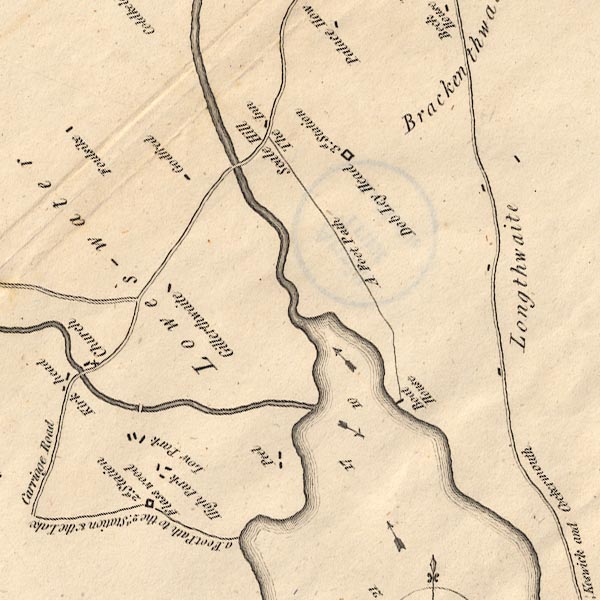 CT8NY12K.jpg "Low Park" item:- Armitt Library : 1959.191.2 Image © see bottom of page |
|
|
|
||
| evidence:- | database:- Listed Buildings 2010 item:- date stone (1812) |
|
| source data:- | courtesy of English Heritage "WEST HOUSE IN A GROUP OF 3, IN THE OCCUPATION OF MR JENKINSON AND MRS MORRIS / / / LOWESWATER / ALLERDALE / CUMBRIA / II / 72705 / NY1441220428" |
|
|
|
||
| evidence:- | database:- Listed Buildings 2010 item:- date stone (1790) |
|
| source data:- | courtesy of English Heritage "MIDDLE UNNAMED HOUSE IN A GROUP OF 3 OWNED BY REV RH WATKINS / / / LOWESWATER / ALLERDALE / CUMBRIA / II / 72706 / NY1444220427" |
|
|
|
||
| evidence:- | database:- Listed Buildings 2010 |
|
| source data:- | courtesy of English Heritage "EAST UNNAMED HOUSE AND BARN ADJOINING IN GROUP OF 3 OWNED BY REV R.H. WATKINS / / / LOWESWATER / ALLERDALE / CUMBRIA / II / 72707 / NY1444820408" |
|
|
|
||
| evidence:- | database:- Listed Buildings 2010 |
|
| source data:- | courtesy of English Heritage "BARN NORTH EAST OF EAST UNNAMED HOUSE IN GROUP OF 3 / / / LOWESWATER / ALLERDALE / CUMBRIA / II / 72708 / NY1446420430" |
|
|
|
||
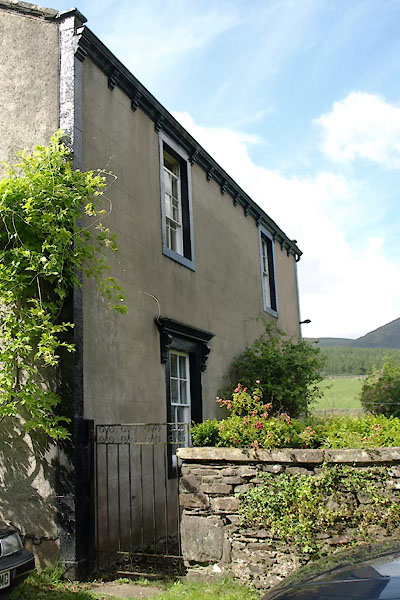 BVF03.jpg (taken 17.8.2011) 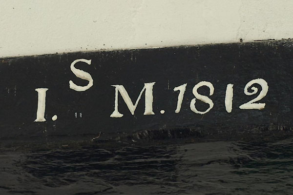 BVF04.jpg Date stone:- "S / I. M. 1812" (taken 17.8.2011) |
||
|
|
||
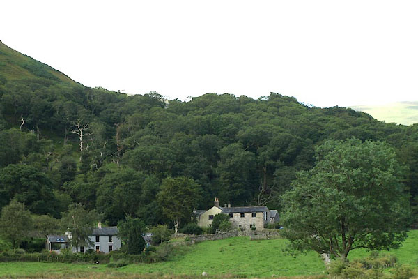 BVF01.jpg From below. (taken 17.8.2011) |
||
|
|
||
Lakes Guides menu.