Old Cumbria Gazetteer
 |
 |
|
||
| Grasmere | ||||
| Gresma | ||||
| Gersma | ||||
| civil parish:- | Lakes (formerly Westmorland) | |||
| county:- | Cumbria | |||
| locality type:- | locality | |||
| locality type:- | buildings | |||
| locality type:- | valley | |||
| locality type:- | selected place | |||
| coordinates:- | NY33660755 (etc) | |||
| 1Km square:- | NY3307 | |||
| 10Km square:- | NY30 | |||
| latitude; longitude:- | 3d 1.4m W; 54d 27.6m N | |||
|
|
||||
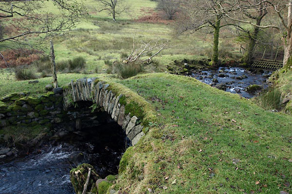
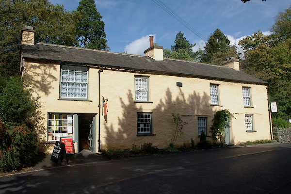
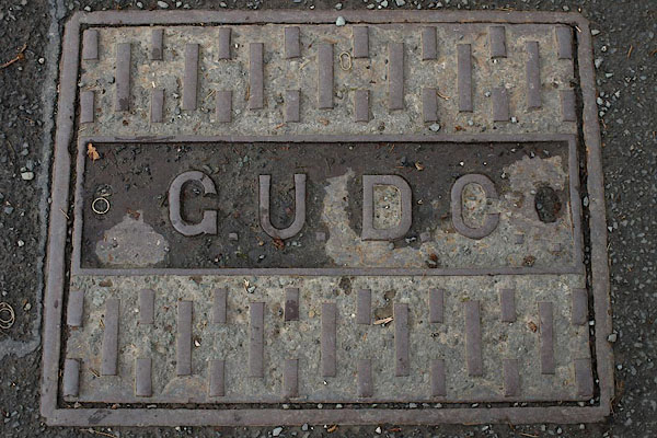
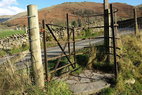
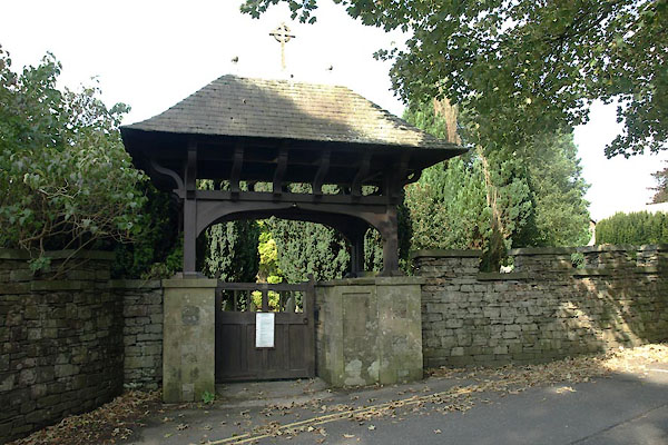
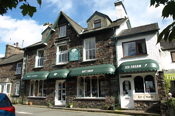
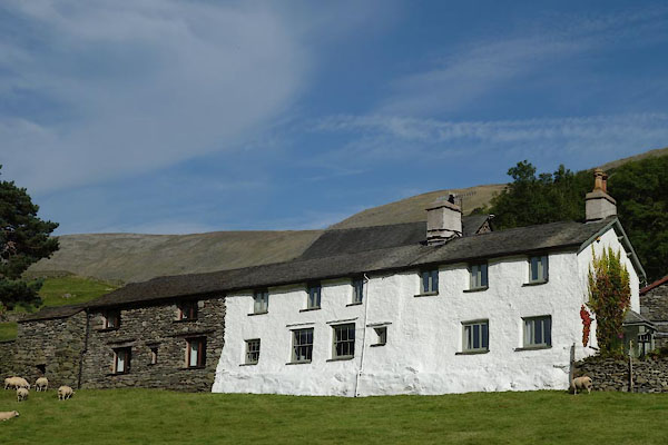
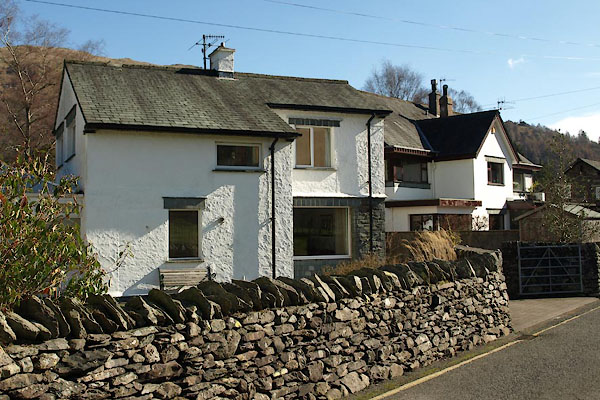
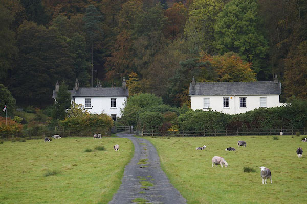
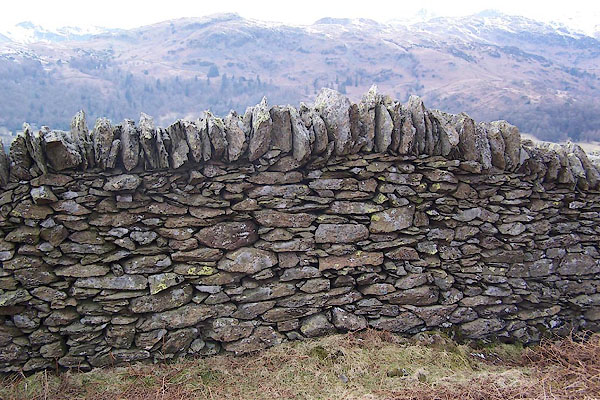
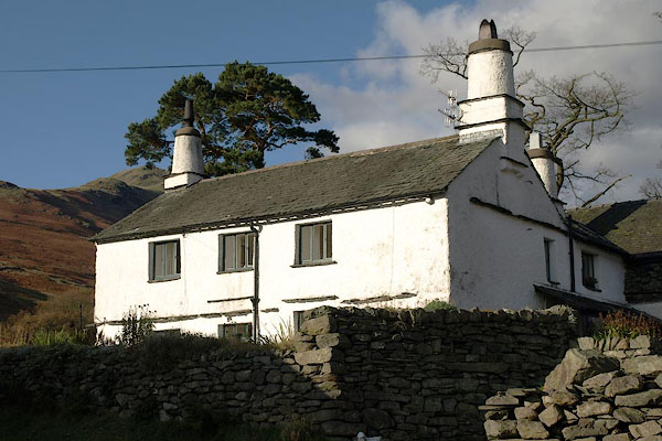
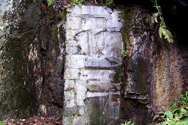
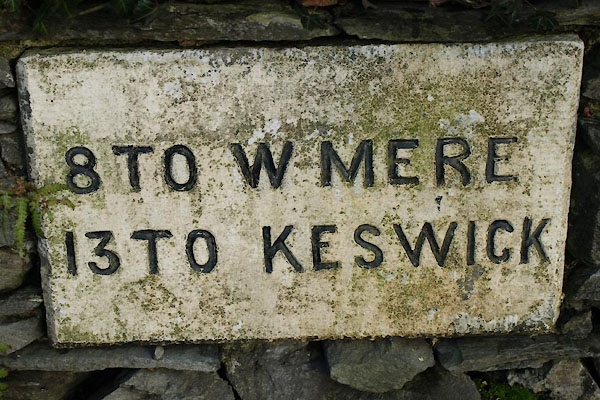
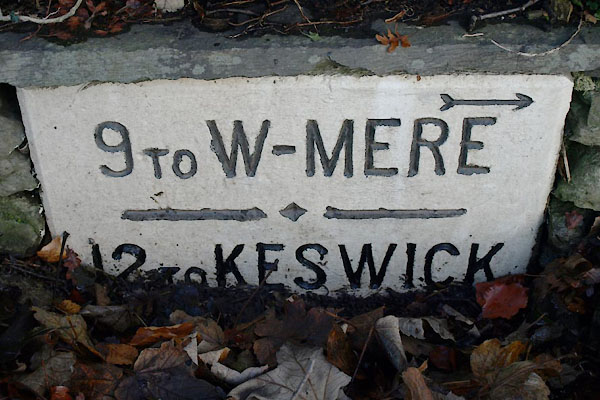
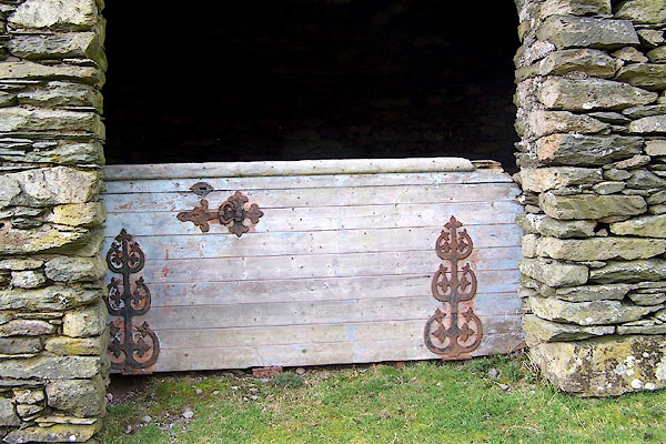
 BRS32.jpg (taken 7.10.2009) 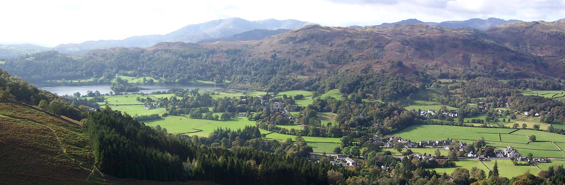 Click to enlarge BRS31.jpg (taken 7.10.2009) |
||||
|
|
||||
| evidence:- | old map:- OS County Series (Wmd 25 4) placename:- Grasmere |
|||
| source data:- | Maps, County Series maps of Great Britain, scales 6 and 25
inches to 1 mile, published by the Ordnance Survey, Southampton,
Hampshire, from about 1863 to 1948. OS County Series (Wmd 26 1) |
|||
|
|
||||
| evidence:- | perhaps descriptive text:- Myddylton 1544 placename:- Grosener |
|||
| source data:- | Book, Cronycle of Yeres, including an early table of highways,
published by Wyllyam Myddylton, at the sign of the George, Fleet
Street, London, 1544. "And also the wayes leadynge to the / most notable places: and the dy- / staunce betwyxte the / same / Anno. 1544" "Here foloweth the waye fro~ Coker / mouth to lancastre, and so to London. / From Cokermouth to Kyswike. vi myle. / from Kyswike to Grosener. viii. myle. / from Grosener to Kendale. xiiii. myle. / from Kendale to Burton. vii. myle. / from Burton to Lancastre. viii. myle. / ..." |
|||
|
|
||||
| evidence:- | old map:- Lloyd 1573 placename:- Grosmer |
|||
| source data:- | Map, hand coloured copper plate engraving, Angliae Regni,
Kingdom of England, with Wales, scale about 24 miles to 1 inch, authored by Humphrey
Lloyd, Denbigh, Clwyd, drawn and engraved
by Abraham Ortelius, Netherlands, 1573. click to enlarge click to enlargeLld1Cm.jpg "Grosmer" item:- Hampshire Museums : FA1998.69 Image © see bottom of page |
|||
|
|
||||
| evidence:- | old map:- Saxton 1579 placename:- Gresmere |
|||
| source data:- | Map, hand coloured engraving, Westmorlandiae et Cumberlandiae Comitatus ie Westmorland
and Cumberland, scale about 5 miles to 1 inch, by Christopher Saxton, London, engraved
by Augustinus Ryther, 1576, published 1579-1645.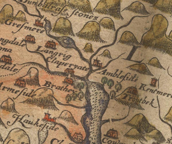 Sax9NY30.jpg Church, symbol for a parish or village, with a parish church. "Gresmere" Settlement. item:- private collection : 2 Image © see bottom of page |
|||
|
|
||||
| evidence:- | old map:- Mercator 1595 (edn?) placename:- Gresmere |
|||
| source data:- | Map, hand coloured engraving, Westmorlandia, Lancastria, Cestria
etc, ie Westmorland, Lancashire, Cheshire etc, scale about 10.5
miles to 1 inch, by Gerard Mercator, Duisberg, Germany, 1595,
edition 1613-16. MER5WmdA.jpg "Gresmere" circle item:- Armitt Library : 2008.14.3 Image © see bottom of page |
|||
|
|
||||
| evidence:- | old map:- Speed 1611 (Wmd) placename:- Gresmere |
|||
| source data:- | Map, hand coloured engraving, The Countie Westmorland and
Kendale the Cheif Towne, scale about 2.5 miles to 1 inch, by
John Speed, 1610, published by George Humble, Popes Head Alley,
London, 1611-12.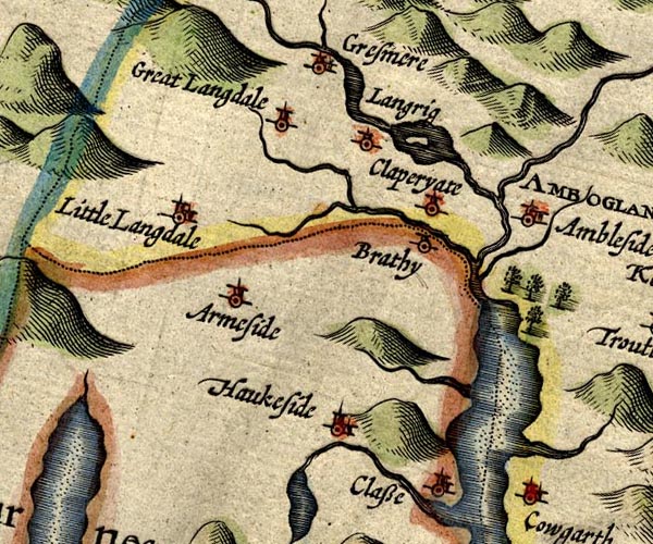 SP14NY30.jpg "Gresmere" circle, building and tower item:- Armitt Library : 2008.14.5 Image © see bottom of page |
|||
|
|
||||
| evidence:- | table of distances:- Simons 1635 placename:- Gresmere |
|||
| source data:- | Table of distances, uncoloured engraving, Westmerland ie
Westmorland, with a thumbnail map, scale about 42 miles to 1
inch, by Mathew Simons, published in A Direction for the English
Traviller, 1635.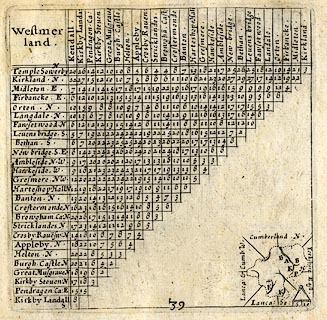 click to enlarge click to enlargeSIM3.jpg "Gresmere N.W." and tabulated distances item:- private collection : 50.39 Image © see bottom of page |
|||
|
|
||||
| evidence:- | old map:- Jansson 1646 placename:- Gresmere |
|||
| source data:- | Map, hand coloured engraving, Cumbria and Westmoria, ie
Cumberland and Westmorland, scale about 3.5 miles to 1 inch, by
John Jansson, Amsterdam, Netherlands, 1646.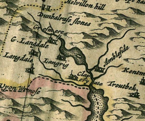 JAN3NY30.jpg "Gresmere" Buildings and tower. item:- JandMN : 88 Image © see bottom of page |
|||
|
|
||||
| evidence:- | hearth tax returns:- Hearth Tax 1675 placename:- Gresmere |
|||
| source data:- | Records, hearth tax survey returns, Westmorland, 1674/75. "Gresmere" |
|||
|
|
||||
| evidence:- | hearth tax returns:- Hearth Tax 1670 placename:- Grassmore |
|||
| source data:- | Records, hearth tax returns, exchequer duplicates, Westmorland,
1670. "Grassmore" |
|||
|
|
||||
| evidence:- | old map:- Ogilby 1675 (plate 96) placename:- Gresmere |
|||
| source data:- | Road strip map, hand coloured engraving, the Road from Kendal to
Cockermouth, and the Road from Egremond to Carlisle, scale about
1 inch to 1 mile, by John Ogilby, London, 1675.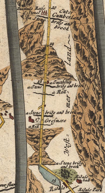 OG96m015.jpg In mile 16, Westmerland. "Gresmere" a church on the left of the road. item:- JandMN : 22 Image © see bottom of page |
|||
|
|
||||
| evidence:- | old map:- Seller 1694 (Wmd) placename:- Gresmere |
|||
| source data:- | Map, hand coloured engraving, Westmorland, scale about 8 miles
to 1 inch, by John Seller, 1694. click to enlarge click to enlargeSEL7.jpg "Gresmere" circle, italic lowercase text; settlement or house item:- Dove Cottage : 2007.38.87 Image © see bottom of page |
|||
|
|
||||
| evidence:- | old map:- Morden 1695 (Cmd) placename:- Gresmere |
|||
| source data:- | Map, uncoloured engraving, Cumberland, scale about 4 miles to 1
inch, by Robert Morden, 1695, published by Abel Swale, the
Unicorn, St Paul's Churchyard, Awnsham, and John Churchill, the
Black Swan, Paternoster Row, London, 1695-1715.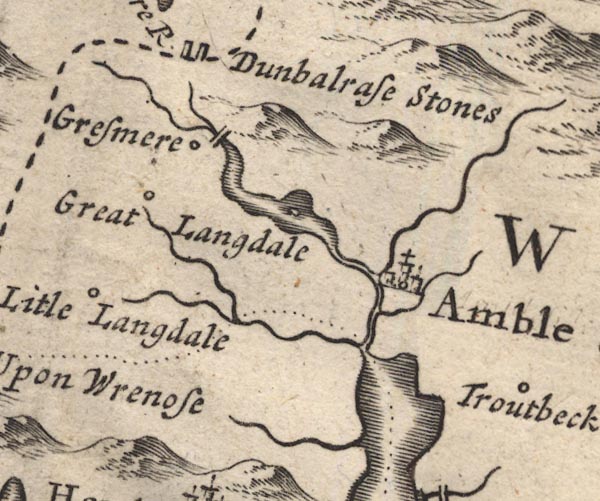 MD12NY30.jpg "Gresmere" Circle. item:- JandMN : 90 Image © see bottom of page |
|||
|
|
||||
| evidence:- | old map:- Morden 1695 (Wmd) placename:- Gresmere |
|||
| source data:- | Map, hand coloured engraving, Westmorland, scale about 2.5 miles to 1 inch, by Robert
Morden, published by Abel Swale, the Unicorn, St Paul's Churchyard, Awnsham, and John
Churchill, the Black Swan, Paternoster Row, London, 1695.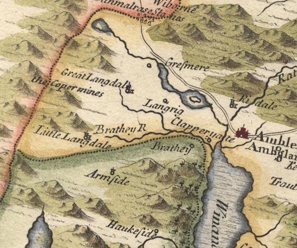 MD10NY30.jpg "Gresmere" Circle. item:- JandMN : 24 Image © see bottom of page |
|||
|
|
||||
| evidence:- | old map:- Simpson 1746 map (Wmd) placename:- Gresmere |
|||
| source data:- | Map, uncoloured engraving, Westmorland, scale about 8 miles to 1
inch, printed by R Walker, Fleet Lane, London, 1746. SMP2NYF.jpg "Gresmere" Circle. item:- Dove Cottage : 2007.38.59 Image © see bottom of page |
|||
|
|
||||
| evidence:- | descriptive text:- Simpson 1746 placename:- Gresmere |
|||
| source data:- | Atlas, three volumes of maps and descriptive text published as
'The Agreeable Historian, or the Compleat English Traveller
...', by Samuel Simpson, 1746. goto source goto sourcePage 1021:- "It [Winander Mere] extends itself like a Sea on the West Side from North-bridge on the South, where it contracts itself again into a River to Gresmere North." |
|||
|
|
||||
| evidence:- | old map:- Bowen and Kitchin 1760 placename:- Gresmere |
|||
| source data:- | Map, hand coloured engraving, A New Map of the Counties of
Cumberland and Westmoreland Divided into their Respective Wards,
scale about 4 miles to 1 inch, by Emanuel Bowen and Thomas
Kitchin et al, published by T Bowles, Robert Sayer, and John
Bowles, London, 1760. BO18NY20.jpg "Gresmere / R" circle, building and tower, rectory item:- Armitt Library : 2008.14.10 Image © see bottom of page |
|||
|
|
||||
| evidence:- | old map:- Jefferys 1770 (Wmd) placename:- Gresmer |
|||
| source data:- | Map, 4 sheets, The County of Westmoreland, scale 1 inch to 1
mile, surveyed 1768, and engraved and published by Thomas
Jefferys, London, 1770. J5NY30NW.jpg "GRESMER" area item:- National Library of Scotland : EME.s.47 Image © National Library of Scotland |
|||
|
|
||||
| evidence:- | descriptive text:- West 1778 (11th edn 1821) |
|||
| source data:- | Guide book, A Guide to the Lakes, by Thomas West, published by
William Pennington, Kendal, Cumbria once Westmorland, and in
London, 1778 to 1821. goto source Page 81:- "... [Mr Gray] '... from the shore [of Grasmere], a low promontory pushes itself far into the water, and on it stands a white village, with a parish church rising in the midst of it; ..." goto sourceAddendum; Mr Gray's Journal, 1769 Page 211:- "... [from Dunmail Raise] ... from the shore [of Grasmere] a low promontory pushes itself far into the water, and on it stands a white village, with the parish church rising in the midst of it; hanging inclosures, corn-fields and meadows, green as an emerald, with their trees, and hedges, and cattle, fill up the whole space from the edge of the water; and just opposite to you is a large farm house, at the bottom of a deep smooth lawn, embosomed in old woods, which climb half way up the mountains' sides, and discover above them a broken line of crags that crown the scene. Not a single red tile, no gentleman's flaring house, or garden walls, break in upon the repose of this little unsuspected paradise; but all its peace, rusticity, and happy poverty, in its neatest, most becoming attire." |
|||
|
|
||||
| evidence:- | old map:- Clarke 1787 map (Ambleside to Keswick) placename:- Grasmere |
|||
| source data:- | Map, A Map of the Roads Lakes etc between Keswick and Ambleside,
scale about 2.5 ins to 1 mile, by James Clarke, engraved by S J
Neele, 352 Strand, published by James Clarke, Penrith,
Cumberland and in London etc, 1787. CL9NY20Z.jpg "GRASMERE" item:- private collection : 10.9 Image © see bottom of page |
|||
|
|
||||
| evidence:- | old text:- goto source placename:- Grassmere placename:- Gresmere |
|||
| source data:- | goto source Page 120:- "..." "I shall here give an extract from Mr Gray's journal, (because I would wish to be thought impartial in every description.)" ""... Just beyond it [Helm Crag] opens one of the sweetest landscapes that art ever attempted to imit[ate]: the bosom of the mountains spreading here into a broad bason, discovers in the midst Grassmere-Water; ... a low promontory pushes itself far into the water, and on it stands a white village with the parish church rising in the midst of it; hanging inclosures, corn-fields, and meadows with their trees, hedges, and cattle, fill up the whole space from the edge of the water; and just opposite to you is a large farm house at the bottom of a steep smooth lawn, embosomed in old woods, which climb half way up the mountain's side, and discover above them a broken line of craggs that crown the scene. Not a single red tile, no gentleman's floring-house or garden breaks in upon the repose of this little unsuspected paradise; but all is peace, rusticity, and happy poverty, in its neatest, most becoming attire." Mr Gray's description is pretty accurate, but this sublime way of writing (as Mr West calls it) is not my province; a guide ought, in my opinion, to be merely narrative. I admire this little place very much myself, and I think here is a station for the artist, equal, if not superior to any in this part. It is upon the side of a round hill called Butter-lip-how; Mr Farrington has taken one of his lately published from below Tail-end, which looks exceeding well; but in this you have a church, and adjoining it an arched bridge, which are certainly great additions in the front of a landscape; behind them the Lake, with the island upon it, appearing very distinctly, with wooded banks behind them: on each side of the lake is a road; one leading to Ambleside, the other to Hawkshead; at the back of all a very high mountain spotted with rubbish from the slate quarries thereon, and not at too great a distance." "In this little amphitheatre may be found several good stations for the landscape painter, and a sweet retired situation for the studious mind; only it is at rather too great a distance from any open country or good market town; the streams for fishing are small, and the want of (variety which is always the case in little places) soon cloys the imagination." "Grassmere, or Gresmere, is part of the great barony of Kendale, and is leased of the crown by the Earl of Lonsdale: when Queen Catherine, wife of Charles the II. held Grassmere, we find it consisted of both the Marquis and Richmond fees; for by an inquisition the 28th of Charles the II. she held thirty-nine customary tenements in Grassmere of the Marquis's fee, of the yearly rent of 11l. 6s. 2d. and thirty-five tenements in Grassmere of Richmond fee, of the yearly rent of 6l. 12s. 4d. also forest silver 2l. 4s. 5d. Brewfarm eight-pence, Goldwether seven-pence, with heriot service." goto sourcePage 121:- "Queen Elizabeth got possession of both, and King James the I. granted the whole to his son the Prince of Wales to support his princely dignity. ..." |
|||
|
|
||||
| evidence:- | old print:- Smith 1795 |
|||
| source data:- | Print uncoloured engraving, with some aquatint, Grasmere Lake, Westmorland, drawn
by John 'Warwick' Smith, engraved by F Merigot, published by R Blamire, Strand, London,
1795.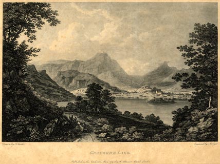 click to enlarge click to enlargePR1852.jpg printed, bottom left, right, centre "Drawn by J. Smith. / Engraved by Merigot. / GRASMERE LAKE. / Published as the Act directs, May, 1795, by Rd. Blamire, Strand, London." item:- Armitt Library : 2011.67 Image © see bottom of page |
|||
|
|
||||
| evidence:- | old map:- Cooke 1802 placename:- Grasmere |
|||
| source data:- | Map, The Lakes, Westmorland and Cumberland, scale about 8.5
miles to 1 inch, engravedby Neele and Son, published by
Sherwood, Jones and Co, Paternoster Road, London, 1824. click to enlarge click to enlargeGRA1Lk.jpg "Grasmere" locality item:- Hampshire Museums : FA2000.62.5 Image © see bottom of page |
|||
|
|
||||
| evidence:- | old text:- Gents Mag |
|||
| source data:- | Magazine, The Gentleman's Magazine or Monthly Intelligencer or
Historical Chronicle, published by Edward Cave under the
pseudonym Sylvanus Urban, and by other publishers, London,
monthly from 1731 to 1922. goto source Gentleman's Magazine 1805 p.1010 "... passed Loughrigg Tarn, a Lake not larger than an orchard-pond, and descended by a steep and narrow track into that glorious amphitheatre of rock, which shuts in the little peaceful vale of Grasmere. Here Nature has worked with the hand of an Enchantress, and I do not envy the Philosopher his feelings who can pass it without emotion. For myself, I could only exclaim with the Poet, "Sic meae sedes utinam Senectae." the white church shot up its taper spire from among a group of scattered cottages at the remotest corner of the valley. This presented a pastoral landscape, rich in trees and cattle; and finished with all the minuteness of a pencil; while the Lake, like a sheet of polished silver, reflected every leaf in its bosom. Here too, is a green islet, but it is subject to the undisputed dominion of the water-fowl. In such a spot, where nothing is to be seen or heard that can disturb the interest derived from Nature, it is surely not surprising, if some distaste should be excited to the bustle of commerce and the "busy hum of men." ..." |
|||
|
|
||||
| evidence:- | old text:- Capper 1808 placename:- Grassmere item:- population |
|||
| source data:- | Gazetteer, A Topographical Dictionary of the United Kingdom,
compiled by Benjamin Pitts Capper, published by Richard
Phillips, Bridge Street, Blackfriars, London, 1808; published
1808-29. goto source "..." "GRASSMERE, a parish in Kendal ward, Westmoreland, 3 miles from Ambleside, and 277 from London; containing 57 houses and 270 inhabitants. From the top of Grassmere hill is a most beautiful prospect. The church stands at a small distance from Grassmere water or lake, on the side of the river Rothay. The living is a rectory, value 28l. 11s. 5d." "..." |
|||
|
|
||||
| evidence:- | old map:- Cooper 1808 placename:- Grasmere |
|||
| source data:- | Map, hand coloured engraving, Westmoreland ie Westmorland, scale
about 9 miles to 1 inch, by H Cooper, 1808, published by R
Phillips, Bridge Street, Blackfriars, London, 1808. click to enlarge click to enlargeCOP4.jpg "Grasmere" circle; village or hamlet item:- Dove Cottage : 2007.38.53 Image © see bottom of page |
|||
|
|
||||
| evidence:- | old map:- Otley 1818 placename:- Grasmere |
|||
| source data:- | Map, uncoloured engraving, The District of the Lakes,
Cumberland, Westmorland, and Lancashire, scale about 4 miles to
1 inch, by Jonathan Otley, 1818, engraved by J and G Menzies,
Edinburgh, Scotland, published by Jonathan Otley, Keswick,
Cumberland, et al, 1833.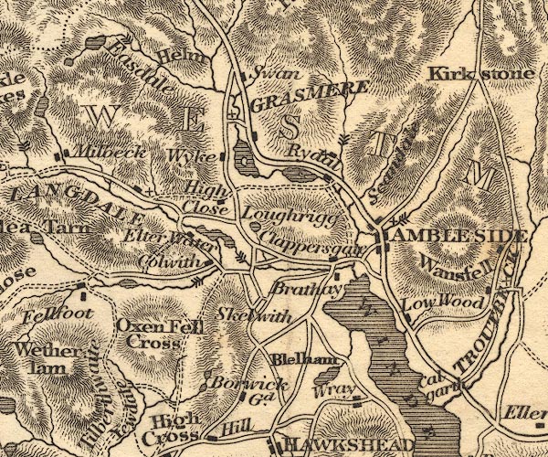 OT02NY30.jpg "GRASMERE" item:- JandMN : 48.1 Image © see bottom of page |
|||
|
|
||||
| evidence:- | descriptive text:- Otley 1823 (5th edn 1834) item:- geology |
|||
| source data:- | Guide book, A Concise Description of the English Lakes, the
mountains in their vicinity, and the roads by which they may be
visited, with remarks on the mineralogy and geology of the
district, by Jonathan Otley, published by the author, Keswick,
Cumberland now Cumbria, by J Richardson, London, and by Arthur
Foster, Kirkby Lonsdale, Cumbria, 1823; published 1823-49,
latterly as the Descriptive Guide to the English Lakes. goto source Page 155:- "The SECOND division [of slate rocks] comprehends the mountains of Eskdale, Wasdale, Ennerdale, Borrowdale, Langdale, Grasmere, Patterdale, Martindale, Mardale, and some adjacent places; including the two highest mountains of the district, Scawfell and Helvellyn, as well as the Old Man at Coniston. All our fine towering crags belong to it; and most of the cascades among the lakes fall over it. There are indeed some lofty precipices in the former division; ..." "..." |
|||
|
|
||||
| evidence:- | old map:- Greenwood 1824 (Wmd) placename:- Grasmere |
|||
| source data:- | Map, hand coloured engraving, Map of the County of Westmorland,
scale about 1 inch to 1 mile, by C and J Greenwood, published by
George Pringle jnr, 70 Queen Street, Cheapside, London, 1824.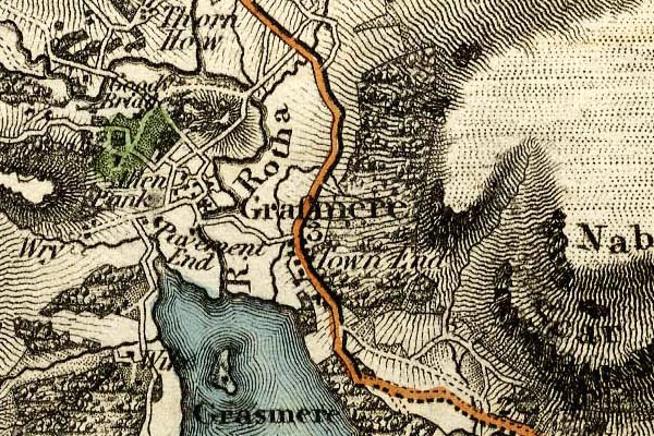 grw5grsm.jpg "Grasmere" street map; labelled in lower case for a parish or township. item:- Armitt Library : A1827 Image © see bottom of page |
|||
|
|
||||
| evidence:- | descriptive text:- Ford 1839 (3rd edn 1843) placename:- Grasmere |
|||
| source data:- | Guide book, A Description of Scenery in the Lake District, by
Rev William Ford, published by Charles Thurnam, Carlisle, by W
Edwards, 12 Ave Maria Lane, Charles Tilt, Fleet Street, William
Smith, 113 Fleet Street, London, by Currie and Bowman,
Newcastle, by Bancks and Co, Manchester, by Oliver and Boyd,
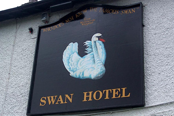
Edinburgh, and by Sinclair, Dumfries, 1839. goto source Page 42:- "..." "... felicitously described by the master-hand of Wordsworth:" "'- So we descend; and winding round a rock, Attain a point that showed the valley; stretch'd In length before us, and not distant far, Upon a rising ground, a grey church-tower, Whose battlements were screened by tufted trees. And, tow'rds a crystal mere, that lay beyond Among steep hills and woods embosomed, flow'd A copious stream with boldly-winding course; Here traceable, there hidden - there again To sight restor'd, and glittering in the sun. On the stream's bank, and every where, appear'd Fair dwellings, single or in social knots; Some scattered o'er the level, others perch'd On the hill-side, a cheerful quiet scene, Now in its morning purity array'd.'" goto sourcePage 163:- "..." "GRASMERE is a mile beyond Rydal, and is surrounded by an amphitheatre of mountains, from any elevated situations on which, and wherever" goto sourcePage 164:- "chosen, romantic views may be obtained of this most lovely vale and its green-enamelled lake, with the fine old church and the white-washed houses shining out from amidst their wood-girt enclosures. The Swan Inn stands by the road-side, and a little distant on the left, near the church, is the Red Lion. Both these inns will afford sufficient accommodation for a tourist, disposed to journey into the hidden beauties of this and its auxiliary vale of Easedale. ..." |
|||
|
|
||||
| evidence:- | old map:- Ford 1839 map placename:- Grasmere |
|||
| source data:- | Map, uncoloured engraving, Map of the Lake District of
Cumberland, Westmoreland and Lancashire, scale about 3.5 miles
to 1 inch, published by Charles Thurnam, Carlisle, and by R
Groombridge, 5 Paternoster Row, London, 3rd edn 1843.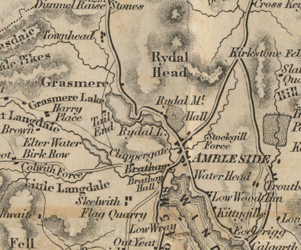 FD02NY30.jpg "Grasmere" item:- JandMN : 100.1 Image © see bottom of page |
|||
|
|
||||
| evidence:- | old drawing:- Aspland 1840s-60s placename:- Grasmere |
|||
| source data:- | Drawing, pencil, Grasmere, Westmorland, by Theophilus Lindsey Aspland, 1857.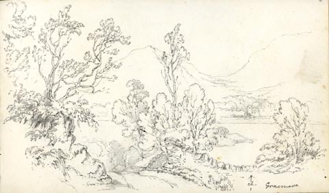 click to enlarge click to enlargeAS0502.jpg "Grasmere" page number "2" item:- Armitt Library : 1958.389.2 Image © see bottom of page |
|||
|
|
||||
| evidence:- | old drawing:- Aspland 1840s-60s |
|||
| source data:- | Drawing, pencil, Grasmere, Westmorland, by Theophilus Lindsey Aspland, 1857.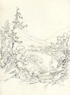 click to enlarge click to enlargeAS0503.jpg page number "2+" item:- drawing Armitt Library : 1958.389.3 Image © see bottom of page |
|||
|
|
||||
| evidence:- | possibly old drawing:- Aspland 1840s-60s |
|||
| source data:- | Drawing, pencil, house, near Grasmere? Westmorland, by Theophilus Lindsey Aspland,
1857.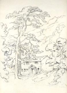 click to enlarge click to enlargeAS0504.jpg page number "3" item:- Armitt Library : 1958.389.4 Image © see bottom of page |
|||
|
|
||||
| evidence:- | possibly old drawing:- Aspland 1840s-60s |
|||
| source data:- | Drawing, pencil, house, near Grasmere? Westmorland, by Theophilus Lindsey Aspland,
1857.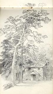 click to enlarge click to enlargeAS0505.jpg page number "4" item:- drawing Armitt Library : 1958.389.5 Image © see bottom of page |
|||
|
|
||||
| evidence:- | old drawing:- Aspland 1840s-60s |
|||
| source data:- | Drawing, pencil, house, Grasmere, Westmorland, by Theophilus Lindsey Aspland, 1857.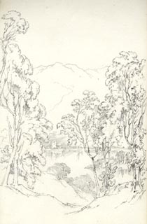 click to enlarge click to enlargeAS0506.jpg page number "5" item:- Armitt Library : 1958.389.6 Image © see bottom of page |
|||
|
|
||||
| evidence:- | old drawing:- Aspland 1840s-60s |
|||
| source data:- | Drawing, pencil, Grasmere village and lake, Westmorland, by Theophilus Lindsey Aspland,
1857.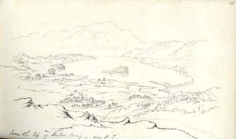 click to enlarge click to enlargeAS0564.jpg "from the top of Helm Crag. / see p.7" page number "48" item:- Armitt Library : 1958.389.64 Image © see bottom of page |
|||
|
|
||||
| evidence:- | old drawing:- Aspland 1840s-60s |
|||
| source data:- | Drawing, pencil, Grasmere, Westmorland, by Theophilus Lindsey Aspland, 1852.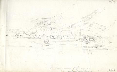 click to enlarge click to enlargeAS0303.jpg "See large view of Grasmere / on yellow paper." page number "13/2b" item:- Armitt Library : 1958.390.3 Image © see bottom of page |
|||
|
|
||||
| evidence:- | old drawing:- Aspland 1840s-60s |
|||
| source data:- | Drawing, pencil, Mr Orrells House, near Grasmere, Westmorland, by Theophilus Lindsey
Aspland, 1852.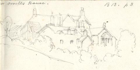 click to enlarge click to enlargeAS0304.jpg "Mr Orrells House. / B13. 1P3" page number "13/2C / r" item:- Armitt Library : 1958.390.4 Image © see bottom of page |
|||
|
|
||||
| evidence:- | old drawing:- Aspland 1840s-60s |
|||
| source data:- | Drawing, pencil, Grasmere, Westmorland, by Theophilus Lindsey Aspland, 16 April 1852.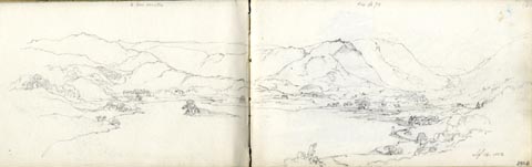 click to enlarge click to enlargeAS0305.jpg "[arrow down] Mr Orrells / see p 70" "Apl. 16. 1852" page number "(3)" item:- Armitt Library : 1958.390.5 Image © see bottom of page |
|||
|
|
||||
| evidence:- | old map:- Garnett 1850s-60s H placename:- Grasmere |
|||
| source data:- | Map of the English Lakes, in Cumberland, Westmorland and
Lancashire, scale about 3.5 miles to 1 inch, published by John
Garnett, Windermere, Westmorland, 1850s-60s. GAR2NY30.jpg "Grasmere" blocks, settlement, and a cross, a church item:- JandMN : 82.1 Image © see bottom of page |
|||
|
|
||||
 Martineau Directory 1855 Martineau Directory 1855 |
||||
|
|
||||
| evidence:- | old text:- Martineau 1855 item:- placename, Grasmere; wild boar |
|||
| source data:- | Guide book, A Complete Guide to the English Lakes, by Harriet
Martineau, published by John Garnett, Windermere, Westmorland,
and by Whittaker and Co, London, 1855; published 1855-76. goto source Page 49:- "... At the further end [of Grasmere lake] lies the village, with its old square church tower, beneath whose shadow Wordsworth is buried. ..." goto sourcePage 163:- "... Grasmere and Grisedale have the same derivation,- Gris being the old Saxon for wild swine: and these are therefore the lake and the valley of the wild boar. A deep and still retreat must both have been in the days of wild boars." |
|||
|
|
||||
| evidence:- | old photograph:- Bell 1880s-1940s |
|||
| source data:- | Photograph, sepia, Grasmere village and lake from Hunting Stile, Grasmere, Westmorland,
by Herbert Bell, photographer, Ambleside, Westmorland, 1890s.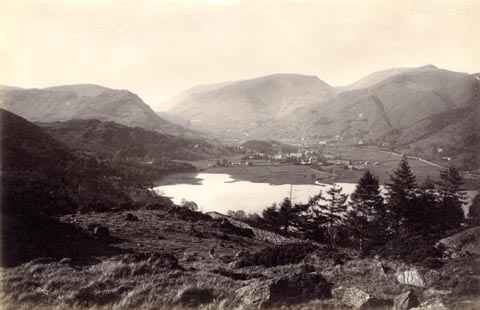 click to enlarge click to enlargeHB0869.jpg internegative at lower left:- "H. Bell" item:- Armitt Library : ALPS540 Image © see bottom of page |
|||
|
|
||||
| evidence:- | old photograph:- Bell 1880s-1940s |
|||
| source data:- | Photograph, black and white, Grasmere, and Helm Crag, Westmorland, by Herbert Bell,
photographer, Ambleside, Westmorland, 1890s.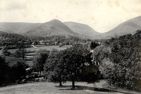 click to enlarge click to enlargeHB0559.jpg stamped on reverse:- "HERBERT BELL / Photographer / AMBLESIDE" item:- Armitt Library : ALPS219 Image © see bottom of page |
|||
|
|
||||
| evidence:- | old photograph:- Bell 1880s-1940s |
|||
| source data:- | Photograph, black and white, Grasmere, Westmorland, by Herbert Bell, photographer,
Ambleside, Westmorland, 1890s.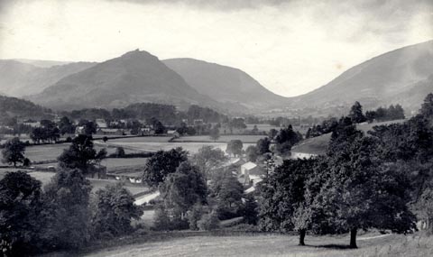 click to enlarge click to enlargeHB0566.jpg stamped on reverse:- "HERBERT BELL / Photographer / AMBLESIDE" item:- Armitt Library : ALPS226 Image © see bottom of page |
|||
|
|
||||
| evidence:- | old map:- Green 1902 placename:- Grasmere |
|||
| source data:- | Map, hand coloured? lithograph, Bathymetrical Survey of Grasmere
Lake, scale about 25 ins to 1 mile, by T A Green, Grasmere,
Westmorland, 1902. click to enlarge click to enlargeM084Vil3.jpg item:- Armitt Library : 1959.195 Image © see bottom of page |
|||
|
|
||||
| evidence:- | text:- Mason 1907 (edn 1930) item:- gravestone |
|||
| source data:- | Text book, The Ambleside Geography Books bk.III, The Counties of
England, by Charlotte M Mason, published by Kegan Paul, Trench,
Trubner and Co, Broadway House, 68-74 Carter Lane, and the
Parents' Educational Union Office, 26 Victoria Street, London,
edn 1930. MSN1P020.txt Page 20:- "..." "... Grasmere ... The grave of Wordsworth is in the village churchyard. ..." |
|||
|
|
||||
| evidence:- | old map:- Postlethwaite 1877 (3rd edn 1913) placename:- Grasmere |
|||
| source data:- | Map, uncoloured engraving, Map of the Lake District Mining Field, Westmorland, Cumberland,
Lancashire, scale about 5 miles to 1 inch, by John Postlethwaite, published by W H
Moss and Sons, 13 Lowther Street, Whitehaven, Cumberland, 1877 edn 1913. PST2NY30.jpg "GRASMERE" dots, roads item:- JandMN : 162.2 Image © see bottom of page |
|||
|
|
||||
| evidence:- | old text:- Burrow 1920s placename:- |
|||
| source data:- | Road book, strip maps with parts in Westmorland, Cumberland etc,
irregular scales about 1.5 miles to 1 inch, by E J Burrow and
Co, Cheltenham, Gloucestershire, 1920s. "... At the northern end of the lake is Grasmere village, a great place of literary pilgrimage, for Wordsworth is buried in the churchyard. But Grasmere village is also resorted to for the famous lakeland sports held here." |
|||
|
|
||||
| Post Office maps |
||||
|
|
||||
| evidence:- | old print:- Pearson 1900s placename:- Grasmere |
|||
| source data:- | Print, halftone photograph, Grasmere from the Old Road, Westmorland, published by
C Arthur Pearson, Henrietta Street, London, 1900s.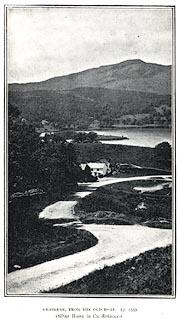 click to enlarge click to enlargePS1E04.jpg On p.7 of Pearson's Gossipy Guide to the English Lakes and Neighbouring Districts. printed at bottom:- "GRASMERE FROM THE OLD ROAD. (P.153). / (Silver Howe in the distance.)" item:- Armitt Library : A1188.11 Image © see bottom of page |
|||
|
|
||||
| evidence:- | old map:- Hudson 1842 (4th edn 1853) placename:- Grasmere |
|||
| source data:- | Map, uncoloured engraving, Eight Miles round Grasmere, engraved
by W Banks, Edinburgh, published by John Hudson, Kendal,
Westmorland, 1853.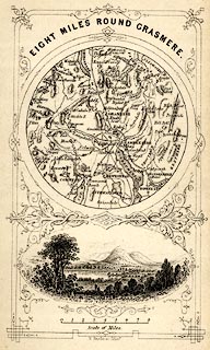 click to enlarge click to enlargeHUD1M1.jpg Map, uncoloured engraving, Eight Miles round Grasmere, engraved by W Banks, Edinburgh, published by John Hudson, Kendal, Westmorland, 1853. Circular map, with a vignette view of Grasmere lake and Helm Crag below. Tipped in opp p.58 in A Complete Guide to the Lakes, edited John Hudson. printed at top:- "EIGHT MILES ROUND GRASMERE." printed at bottom:- "W. Banks, sc. Edinr." item:- JandMN : 327.4 Image © see bottom of page |
|||
|
|
||||
| evidence:- | old print:- Rose 1832-35 |
|||
| source data:- | Print, engraving, Grasmere Lake and Village, by George Pickering, engraved by C Mottram,1833.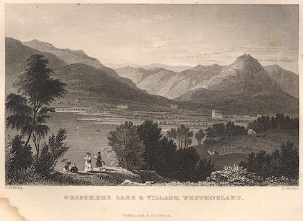 click to enlarge click to enlargeR156.jpg item:- JandMN : 66.12 Image © see bottom of page |
|||
|
|
||||
| hearsay:- |
Thomas de Quincey, in his Recollections of the Lakes, wrote: |
|||
| "A very interesting feature of the elder architecture, annually becoming more and more
rare viz. the outside gallery, which is sometimes merely of wood, but is much more
striking when provided for in the original construction of the house and completely
enfoncee in the masonry." |
||||
|
|
||||
| notes:- |
From 1905, the village was served by steam motor buses, known as the Yellow Perils. |
|||
|
|
||||
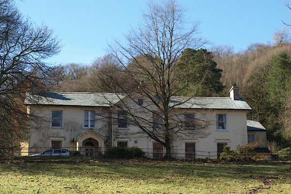
| Paley and Austin series | ||||
| person:- | architect : Austin, Hubert J |
|||
| person:- | architect : Paley, Henry A |
|||
| date:- | 1911 |
|||
| Extension to house of the Misses Paley in Michaels Fold area. |
||||
|
|
||||
| places:- |
|
|||
|
||||
|
||||
|
||||
|
||||
|
||||
|
||||
|
||||
|
||||
|
||||
|
||||
|
||||
|
||||
|
||||
|
||||
|
||||
|
||||
|
||||
|
||||
|
||||
|
||||
|
||||
|
||||
|
||||
|
||||
|
||||
|
||||
|
||||
|
||||
|
||||
|
||||
|
||||
|
||||
|
||||
|
||||
|
||||
|
||||
|
||||
|
||||
|
||||
|
||||
|
||||
|
||||
|
||||
|
||||
|
||||
|
||||
|
||||
|
||||
|
||||
|
||||
|
||||
|
||||
|
||||
|
||||
|
||||
|
||||
|
||||
|
||||
|
||||
|
||||
|
||||
|
||||
|
||||
|
||||
|
||||
|
||||
|
||||
|
||||
|
||||
|
||||
|
||||
|
||||
|
||||
|
||||
|
||||
|
||||
|
||||
|
||||
|
||||
|
||||
|
||||
|
||||
|
||||
|
||||
|
||||
|
||||
|
||||
|
||||
|
||||
|
||||
|
||||
|
||||
|
||||
|
||||
|
||||
|
||||
|
||||
|
||||
|
||||
|
||||
|
||||
|
||||
|
||||
|
||||
|
||||
|
||||
|
||||
|
||||
|
||||
|
||||
|
||||
|
||||
|
||||
|
||||
|
||||
|
||||
|
||||
|
||||
|
||||
|
||||
|
||||
|
||||
|
||||
|
||||
|
||||
|
||||
|
||||
|
||||
|
||||
|
||||
|
||||
|
||||
|
||||
|
||||
|
||||
|
||||
|
||||
|
||||
|
||||
|
||||
|
||||
|
||||
|
||||
|
||||
|
||||
|
||||
|
||||
|
||||
|
||||
|
||||
|
||||
|
||||
|
||||
|
||||
|
||||
|
||||
|
||||
|
||||
|
||||
|
||||
|
||||
|
||||
|
||||
|
||||
|
||||
|
||||
|
||||
|
||||
|
||||
|
||||
|
||||
|
||||
|
||||
|
||||
|
||||
|
||||
|
||||
|
||||
|
||||
|
||||
|
||||
|
||||
|
||||
|
||||
|
||||
|
||||
|
||||
|
||||
|
||||
|
||||
|
||||
|
||||
|
||||
Lakes Guides menu.