 Old Cumbria Gazetteer
 |
 |
|
| Askham | ||
| civil parish:- | Askham (formerly Westmorland) | |
| county:- | Cumbria | |
| locality type:- | buildings | |
| coordinates:- | NY51292367 (etc) | |
| 1Km square:- | NY5123 | |
| 10Km square:- | NY52 | |
|
|
||
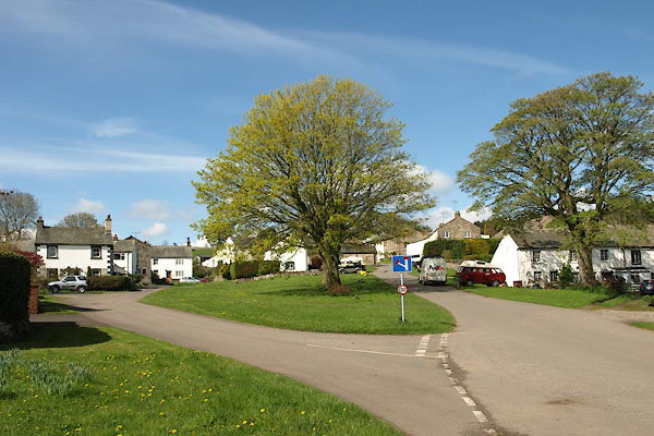
 BJT77.jpg The green at Askham. (taken 22.8.2005) 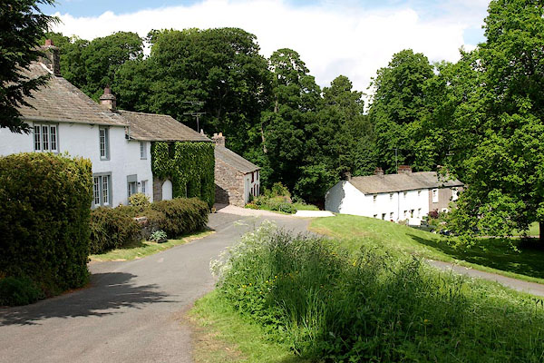 BQU41.jpg (taken 11.6.2009) |
||
|
|
||
| evidence:- | old map:- Saxton 1579 placename:- Askham |
|
| source data:- | Map, hand coloured engraving, Westmorlandiae et Cumberlandiae Comitatus ie Westmorland
and Cumberland, scale about 5 miles to 1 inch, by Christopher Saxton, London, engraved
by Augustinus Ryther, 1576, published 1579-1645.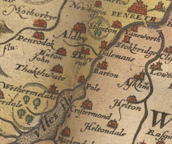 Sax9NY42.jpg Church, symbol for a parish or village, with a parish church. "Askham" item:- private collection : 2 Image © see bottom of page |
|
|
|
||
| evidence:- | old map:- Keer 1605 placename:- Askham |
|
| source data:- | Map, hand coloured engraving, Westmorland and Cumberland, scale
about 16 miles to 1 inch, probably by Pieter van den Keere, or
Peter Keer, about 1605 edition perhaps 1676. click to enlarge click to enlargeKER8.jpg "Askham" dot, circle and tower; village item:- Dove Cottage : 2007.38.110 Image © see bottom of page |
|
|
|
||
| evidence:- | old map:- Speed 1611 (Wmd) placename:- Askham |
|
| source data:- | Map, hand coloured engraving, The Countie Westmorland and
Kendale the Cheif Towne, scale about 2.5 miles to 1 inch, by
John Speed, 1610, published by George Humble, Popes Head Alley,
London, 1611-12.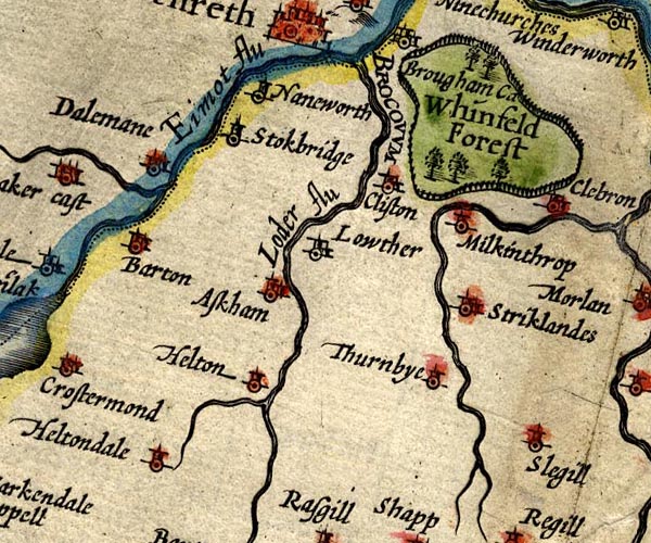 SP14NY52.jpg "Askham" circle, building and tower item:- Armitt Library : 2008.14.5 Image © see bottom of page |
|
|
|
||
| evidence:- | old map:- Jenner 1643 placename:- Askham |
|
| source data:- | Table of distances, with map, hand coloured engraving,
Westmerland ie Westmorland, scale about 16 miles to 1 inch,
engraved by Jacob van Langeren, published by Thomas Jenner,
Cornhill, London, 1643.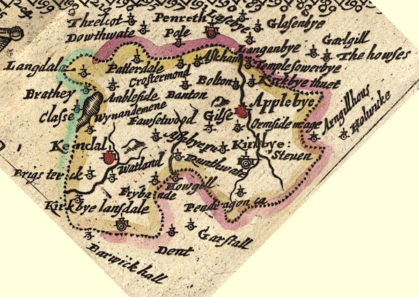 JEN3Sq.jpg "Askham" dot, circle, tower item:- private collection : 52.Wmd Image © see bottom of page |
|
|
|
||
| evidence:- | old map:- Jansson 1646 placename:- Askham |
|
| source data:- | Map, hand coloured engraving, Cumbria and Westmoria, ie
Cumberland and Westmorland, scale about 3.5 miles to 1 inch, by
John Jansson, Amsterdam, Netherlands, 1646.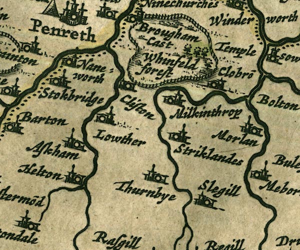 JAN3NY52.jpg "Askham" Buildings and tower. item:- JandMN : 88 Image © see bottom of page |
|
|
|
||
| evidence:- | hearth tax returns:- Hearth Tax 1670 placename:- Askam |
|
| source data:- | Records, hearth tax returns, exchequer duplicates, Westmorland,
1670. "Askam" |
|
|
|
||
| evidence:- | old map:- Morden 1695 (Cmd) placename:- Askham |
|
| source data:- | Map, uncoloured engraving, Cumberland, scale about 4 miles to 1
inch, by Robert Morden, 1695, published by Abel Swale, the
Unicorn, St Paul's Churchyard, Awnsham, and John Churchill, the
Black Swan, Paternoster Row, London, 1695-1715.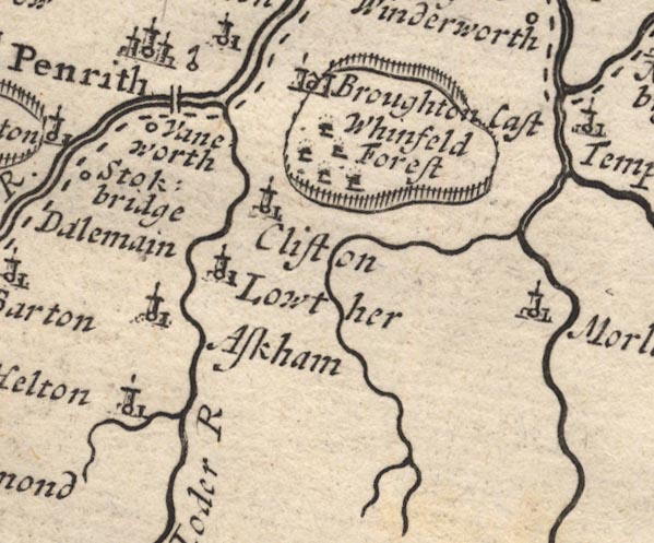 MD12NY52.jpg "Askham" Circle, building and tower. item:- JandMN : 90 Image © see bottom of page |
|
|
|
||
| evidence:- | old map:- Morden 1695 (Wmd) placename:- Askham |
|
| source data:- | Map, hand coloured engraving, Westmorland, scale about 2.5 miles to 1 inch, by Robert
Morden, published by Abel Swale, the Unicorn, St Paul's Churchyard, Awnsham, and John
Churchill, the Black Swan, Paternoster Row, London, 1695.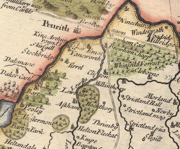 MD10NY52.jpg "Askham" Circle, building and tower. item:- JandMN : 24 Image © see bottom of page |
|
|
|
||
| evidence:- | old map:- Simpson 1746 map (Wmd) placename:- Ask Ham |
|
| source data:- | Map, uncoloured engraving, Westmorland, scale about 8 miles to 1
inch, printed by R Walker, Fleet Lane, London, 1746.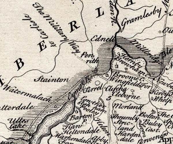 SMP2NYL.jpg "Ask ham" item:- Dove Cottage : 2007.38.59 Image © see bottom of page |
|
|
|
||
| evidence:- | old map:- Bowen and Kitchin 1760 placename:- Askham |
|
| source data:- | Map, hand coloured engraving, A New Map of the Counties of
Cumberland and Westmoreland Divided into their Respective Wards,
scale about 4 miles to 1 inch, by Emanuel Bowen and Thomas
Kitchin et al, published by T Bowles, Robert Sayer, and John
Bowles, London, 1760.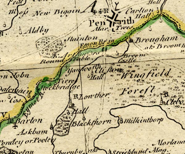 BO18NY42.jpg "Askham" circle, tower item:- Armitt Library : 2008.14.10 Image © see bottom of page |
|
|
|
||
| evidence:- | old map:- Jefferys 1770 (Wmd) placename:- Askham |
|
| source data:- | Map, 4 sheets, The County of Westmoreland, scale 1 inch to 1
mile, surveyed 1768, and engraved and published by Thomas
Jefferys, London, 1770.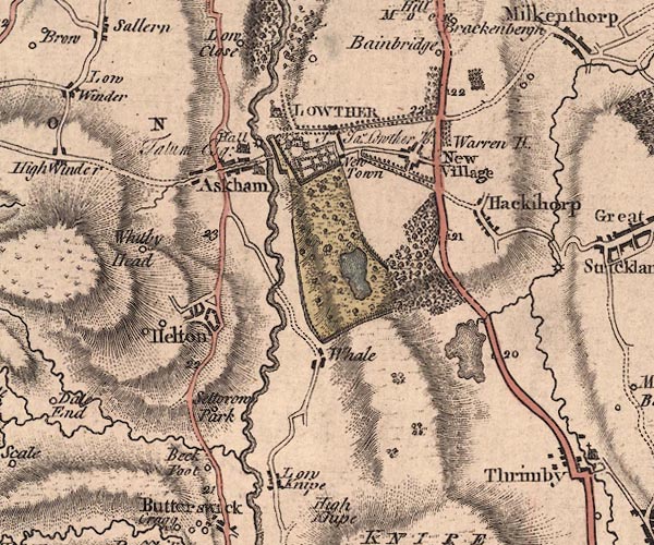 J5NY52SW.jpg "Askham" blocks, labelled in upright lowercase text; settlement; town?; a stream is drawn running down the main street item:- National Library of Scotland : EME.s.47 Image © National Library of Scotland |
|
|
|
||
| evidence:- | old map:- West 1784 map placename:- Askham |
|
| source data:- | Map, hand coloured engraving, A Map of the Lakes in Cumberland,
Westmorland and Lancashire, scale about 3.5 miles to 1 inch,
engraved by Paas, 53 Holborn, London, about 1784.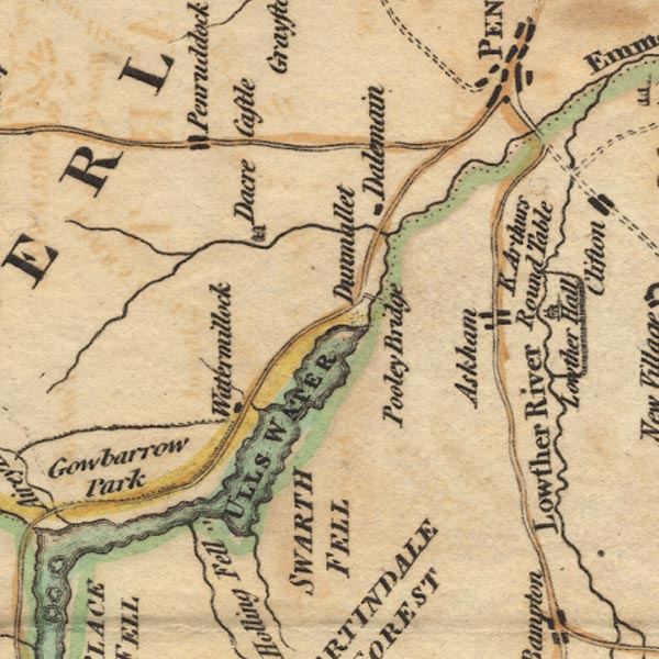 Ws02NY42.jpg item:- Armitt Library : A1221.1 Image © see bottom of page |
|
|
|
||
| evidence:- | old print:- Clarke 1787 placename:- Askham Villa |
|
| source data:- | circle click to enlarge click to enlargeCL18.jpg "Askham Villa" item:- Armitt Library : A6615.12 Image © see bottom of page |
|
|
|
||
| evidence:- | old map:- Cary 1789 (edn 1805) placename:- Askham |
|
| source data:- | Map, uncoloured engraving, Westmoreland, scale about 2.5 miles
to 1 inch, by John Cary, London, 1789; edition 1805.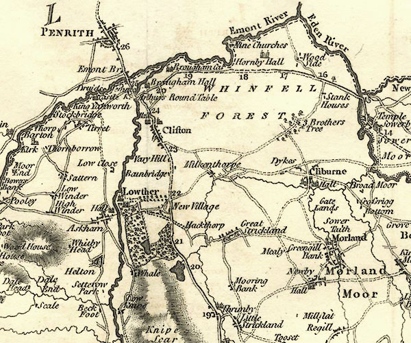 CY24NY52.jpg "Askham" block/s, labelled in italic lowercase; house, or hamlet item:- JandMN : 129 Image © see bottom of page |
|
|
|
||
| evidence:- | old map:- Cooper 1808 placename:- Askham |
|
| source data:- | Map, hand coloured engraving, Westmoreland ie Westmorland, scale
about 9 miles to 1 inch, by H Cooper, 1808, published by R
Phillips, Bridge Street, Blackfriars, London, 1808. click to enlarge click to enlargeCOP4.jpg "Askham" circle; village or hamlet item:- Dove Cottage : 2007.38.53 Image © see bottom of page |
|
|
|
||
| evidence:- | old map:- Otley 1818 placename:- Askham |
|
| source data:- | Map, uncoloured engraving, The District of the Lakes,
Cumberland, Westmorland, and Lancashire, scale about 4 miles to
1 inch, by Jonathan Otley, 1818, engraved by J and G Menzies,
Edinburgh, Scotland, published by Jonathan Otley, Keswick,
Cumberland, et al, 1833.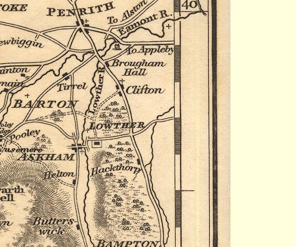 OT02NY52.jpg "ASKHAM" item:- JandMN : 48.1 Image © see bottom of page |
|
|
|
||
| evidence:- | old map:- Hall 1820 (Wmd) placename:- Askham |
|
| source data:- | Map, hand coloured engraving, Westmoreland ie Westmorland, scale
about 14.5 miles to 1 inch, by Sidney Hall, London, 1820,
published by Samuel Leigh, 18 Strand, London, 1820-31. click to enlarge click to enlargeHA18.jpg "Askham" circle, italic lowercase text; settlement item:- Armitt Library : 2008.14.58 Image © see bottom of page |
|
|
|
||
| evidence:- | descriptive text:- Ford 1839 (3rd edn 1843) placename:- Askham |
|
| source data:- | Guide book, A Description of Scenery in the Lake District, by
Rev William Ford, published by Charles Thurnam, Carlisle, by W
Edwards, 12 Ave Maria Lane, Charles Tilt, Fleet Street, William
Smith, 113 Fleet Street, London, by Currie and Bowman,
Newcastle, by Bancks and Co, Manchester, by Oliver and Boyd,
Edinburgh, and by Sinclair, Dumfries, 1839. goto source goto sourcePage 135:- "..." "... Askham, a good village in a pleasant situation, opposite to Lowther Park. ..." |
|
|
|
||
| evidence:- | old map:- Ford 1839 map placename:- Askham |
|
| source data:- | Map, uncoloured engraving, Map of the Lake District of
Cumberland, Westmoreland and Lancashire, scale about 3.5 miles
to 1 inch, published by Charles Thurnam, Carlisle, and by R
Groombridge, 5 Paternoster Row, London, 3rd edn 1843.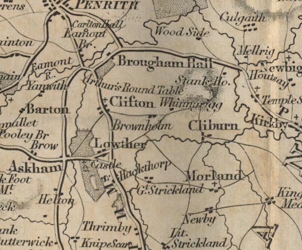 FD02NY52.jpg "Askham" item:- JandMN : 100.1 Image © see bottom of page |
|
|
|
||
| evidence:- | old map:- Garnett 1850s-60s H placename:- Askham |
|
| source data:- | Map of the English Lakes, in Cumberland, Westmorland and
Lancashire, scale about 3.5 miles to 1 inch, published by John
Garnett, Windermere, Westmorland, 1850s-60s.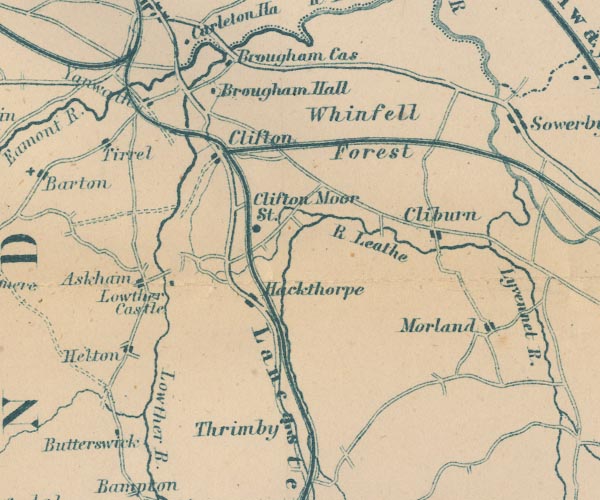 GAR2NY52.jpg "Askham" blocks, settlement item:- JandMN : 82.1 Image © see bottom of page |
|
|
|
||
| evidence:- | old print:- Bradley 1901 placename:- Askham |
|
| source data:- | Print, uncoloured lithograph, Askham Village, Westmorland, by Joseph Pennell, published
by Macmillan and Co, London, 1901.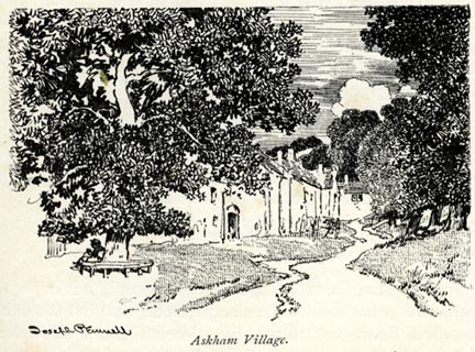 click to enlarge click to enlargeBRL104.jpg On page 31 of Highways and Byways in the Lake District, by A G Bradley. printed at bottom left:- "Joseph Pennell" printed at bottom:- "Askham Village." item:- JandMN : 464.4 Image © see bottom of page |
|
|
|
||
| evidence:- | old print:- Bradley 1901 placename:- Askham |
|
| source data:- | Print, uncoloured lithograph, Askham, Westmorland, by Joseph Pennell, published by
Macmillan and Co, London, 1901.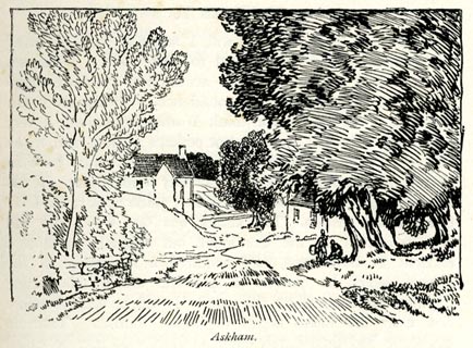 click to enlarge click to enlargeBRL106.jpg On page 35 of Highways and Byways in the Lake District, by A G Bradley. printed at bottom:- "Askham." item:- JandMN : 464.6 Image © see bottom of page |
|
|
|
||
| evidence:- | town plan:- Historical Monuments 1936 |
|
| source data:- | Town plan, uncoloured lithograph, Askham Plan showing the Position of Monuments, Askham,
Westmorland, scale about 1 to 5400, published by Royal Commission on Historical Monuments
England, London, 1936.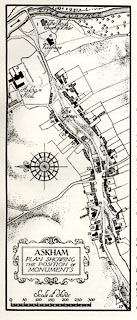 click to enlarge click to enlargeHMW019.jpg On p.23 of the Inventory of the Historical Monuments in Westmorland. printed, lower left "ASKHAM / PLAN SHOWING / THE POSITION OF / MONUMENTS" item:- Armitt Library : A745.19 Image © see bottom of page |
|
|
|
||
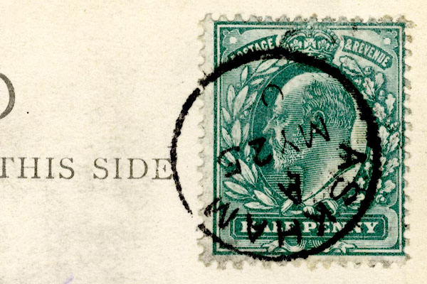 CCS61.jpg Postmark:- "ASKHAM / A / MY 25 / 0[ ]" Stamp - Edward VII, halfpenny, blue green |
||
|
|
||
| evidence:- | old map:- Post Office 1850s-1900s placename:- Askham |
|
| source data:- | Post road maps, General Post Office Circulation Map for England
and Wales, for the General Post Office, London, 1850s-1900s. click to enlarge click to enlargePOF7Cm.jpg "Askham" map date 1909 |
|
|
|
||
| :- |
images courtesy of the British Postal Museum and Hampshire CC Museums |
|
|
|
||
 BWG56.jpg Upper part of the village. (taken 27.4.2012) 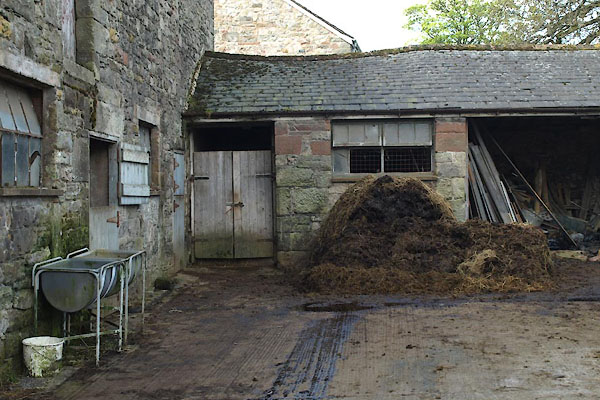 BWH02.jpg Farmyard, (taken 27.4.2012) |
||
|
|
||
Lakes Guides menu.