 Old Cumbria Gazetteer
 |
 |
|
| Archers Hall, Sedbergh | ||
| Archers Hall | ||
| locality:- | Millthrop | |
| civil parish:- | Sedbergh (formerly Yorkshire) | |
| county:- | Cumbria | |
| locality type:- | buildings | |
| coordinates:- | SD65849111 | |
| 1Km square:- | SD6591 | |
| 10Km square:- | SD69 | |
|
|
||
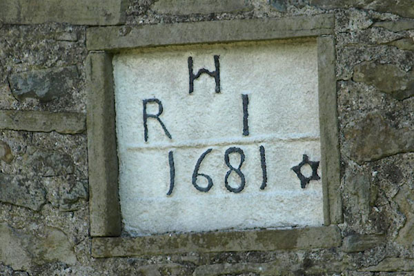 BYK39.jpg Date stone:- "H / R I / 1681" (taken 31.5.2013) 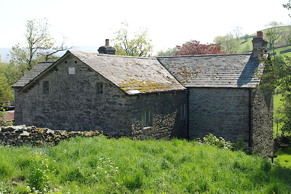 BYK38.jpg Rear view. (taken 31.5.2013) |
||
|
|
||
| evidence:- | old map:- OS County Series (Yrk 63 3) placename:- Archers Hall |
|
| source data:- | Maps, County Series maps of Great Britain, scales 6 and 25
inches to 1 mile, published by the Ordnance Survey, Southampton,
Hampshire, from about 1863 to 1948. |
|
|
|
||
| evidence:- | database:- Listed Buildings 2010 placename:- Archer's Hall item:- date stone (1681) |
|
| source data:- | courtesy of English Heritage "ARCHER'S HALL / / / SEDBERGH / SOUTH LAKELAND / CUMBRIA / II[star] / 484633 / SD6585791111" |
|
|
|
||
| evidence:- | database:- Listed Buildings 2010 |
|
| source data:- | courtesy of English Heritage "SMALL BARN APPROXIMATELY 30 METRES NORTH OF ARCHER'S HALL / / / SEDBERGH / SOUTH LAKELAND / CUMBRIA / II / 484635 / SD6587591141" |
|
|
|
||
| evidence:- | database:- Listed Buildings 2010 |
|
| source data:- | courtesy of English Heritage "BARN APPROXIMATELY 20 METRES TO NORTH WEST OF ARCHER'S HALL / / / SEDBERGH / SOUTH LAKELAND / CUMBRIA / II / 484634 / SD6584091138" |
|
|
|
||
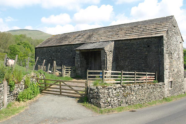 BYK40.jpg Barn opposite. (taken 31.5.2013) |
||
|
|
||
 Lakes Guides menu.