 Old Cumbria Gazetteer
 |
 |
|
| Agnes Gill, Whinfell | ||
| Agnes Gill | ||
| civil parish:- | Whinfell (formerly Westmorland) | |
| county:- | Cumbria | |
| locality type:- | buildings | |
| coordinates:- | SD56829947 | |
| 1Km square:- | SD5699 | |
| 10Km square:- | SD59 | |
|
|
||
| evidence:- | old map:- OS County Series (Wmd 34 6) placename:- Agnesgill |
|
| source data:- | Maps, County Series maps of Great Britain, scales 6 and 25
inches to 1 mile, published by the Ordnance Survey, Southampton,
Hampshire, from about 1863 to 1948. |
|
|
|
||
| evidence:- | old map:- Jefferys 1770 (Wmd) placename:- Anisgill |
|
| source data:- | Map, 4 sheets, The County of Westmoreland, scale 1 inch to 1
mile, surveyed 1768, and engraved and published by Thomas
Jefferys, London, 1770.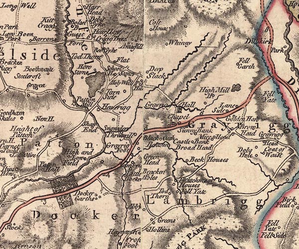 J5SD59NE.jpg "Anisgill" circle, labelled in italic lowercase text; settlement, farm, house, or hamlet? item:- National Library of Scotland : EME.s.47 Image © National Library of Scotland |
|
|
|
||
| evidence:- | probably old map:- Greenwood 1824 (Wmd) placename:- Gill Head |
|
| source data:- | Maps, Map of the County of Westmorland, scale about 1 inch to 1
mile, and Map of the County of Cumberland, scale about 1 inch to
1 mile, etc, by C and J Greenwood, published by George Pringle
jnr, 70 Queen Street, Cheapside, London, 1823 and 1824
respectively. "Gill Head" |
|
|
|
||
| evidence:- | database:- Listed Buildings 2010 placename:- Agnes Gill |
|
| source data:- | courtesy of English Heritage "AGNES GILL / / / WHINFELL / SOUTH LAKELAND / CUMBRIA / II / 75751 / SD5681799477" |
|
|
|
||
 Lakes Guides menu.