 Jansson 1646 SD09


|

|
|
|
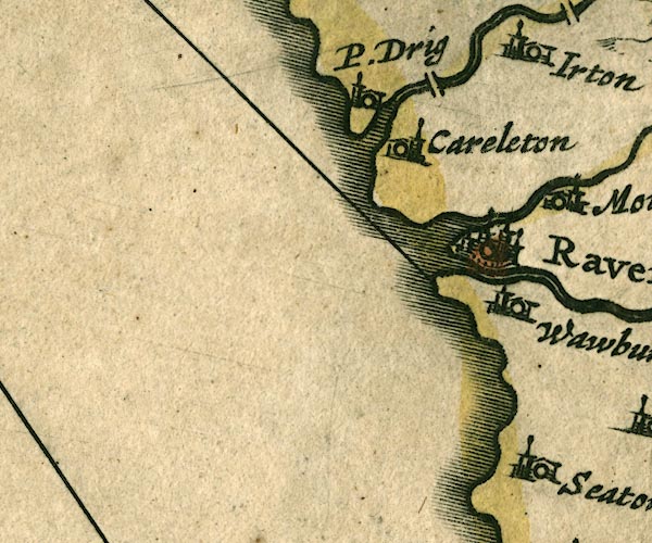
gazetteer links places may or may not be labelled on the map |
||

|
-- Carleton Hall -- "Careleton" |
|
|
|
-- Drigg -- "P. Drig" |
|
|
|
-- Esk, River -- "Denok fl" |
|
|
|
-- Holme Bridge |
|
|
|
-- Irt, River |
|
|
|
-- Mite, River |
|
|
|
-- Ravenglass -- "Ravenglas" |
|
|
|
-- Waberthwaite -- "Wawburthwat" |
|
|
civil parishes The area roughly includes parts of parishes:- Drigg and Carleton Muncaster Seascale Waberthwaite Irton with Santon Bootle |
||
|
|
||
|
|
Lakes Guides menu. | |