 Jansson 1646 NY15


|

|
|
|
gazetteer links places may or may not be labelled on the map |
||

|
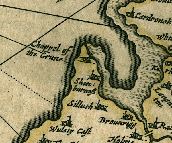
-- Brownrigg -- "Brounrigg" |
|
|
|
-- Cardurnock -- "Cardronok" |
|
|
|
-- Grune Chapel -- "Chappel of the Grune" |
|
|
|
-- Moricambe |
|
|
|
-- Silloth -- "Silluth" |
|
|
|
-- Skinburness -- "Skinburness" |
|
|
|
-- Wolsty Castle (?) -- "Wulstÿ Cast." |
|
|
civil parishes The area roughly includes parts of parishes:- Holme Low Holme St Cuthbert Holme Abbey Holme East Waver Dundraw Silloth-on-Solway |
||
|
|
||
|
|
Lakes Guides menu. | |