 Jansson 1646 NY01


|

|
|
|
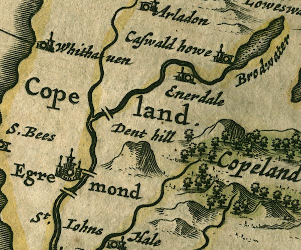
gazetteer links places may or may not be labelled on the map |
||

|
-- Blackhow Bridge |
|
|
|
-- Briscoemill Bridge |
|
|
|
-- Dent -- "Dent hill" |
|
|
|
-- Egremont -- "Egremond" |
|
|
|
-- Ehen, River |
|
|
|
-- Ennerdale Bridge -- "Enerdale" |
|
|
|
-- How Hall Farm -- "Caswald howe" |
|
|
|
-- Keekle, River |
|
|
|
-- Old Bridge (?) |
|
|
|
-- Whitehaven -- "Whithaven" |
|
|
civil parishes The area roughly includes parts of parishes:- Haile St John Beckermet Ennerdale and Kinniside Cleator Moor Arlecdon and Frizington St Bees Egremont Whitehaven Weddicar Moresby St Bridget Beckermet Lowside Quarter Lamplugh |
||
|
|
||
|
|
Lakes Guides menu. | |