 Ford 1839 map SD69


|

|
|
|
gazetteer links places may or may not be labelled on the map |
||

|
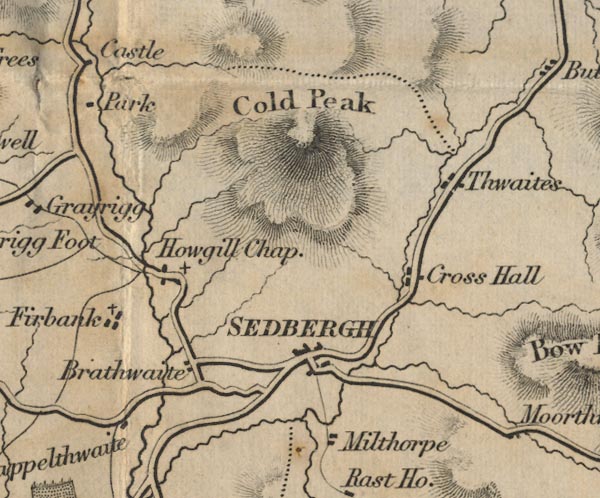
-- Branthwaite -- "Brathwaite" |
|
|
|
-- Calders -- "Cold Peak" |
|
|
|
-- Capplethwaite Hall -- "Cappelthwaite" |
|
|
|
-- Cautley Thwaite -- "Thwaites" |
|
|
|
-- Cross Hall -- "Cross Hall" |
|
|
|
-- Firbank -- "Firbank" |
|
|
|
-- Holy Trinity Church -- "Howgill Chap." |
|
|
|
-- Millthrop -- "Milthorpe" |
|
|
|
-- Sedbergh -- "SEDBERGH" |
|
|
civil parishes The area roughly includes parts of parishes:- Orton S Grayrigg Killington Firbank Lambrigg Middleton Tebay Dent Ravenstonedale Garsdale Sedbergh |
||
|
|
||
|
|
Lakes Guides menu. | |