 Ford 1839 map SD57


|

|
|
|
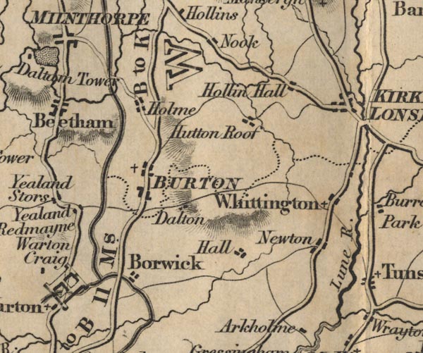
gazetteer links places may or may not be labelled on the map |
||

|
-- Borwick -- "Borwick" |
|
|
|
-- Burton-in-Kendal -- "BURTON" |
|
|
|
-- Docker Hall -- "Hall" |
|
|
|
-- Hollin Hall -- "Hollin Hall" |
|
|
|
-- Holme -- "Holme" |
|
|
|
-- Hutton Roof -- "Hutton Roof" |
|
|
|
-- Kirkby Lonsdale -- "KIRKBY LONSDALE" |
|
|
|
-- Lancaster Canal |
|
|
|
-- Lune, River -- "Lune R." |
|
|
|
-- Newton -- "Newton" |
|
|
|
-- Nook -- "Nook" |
|
|
|
-- Lancaster to Kendal -- "B to K 11 Ms." -- "L to
B 11 Ms." |
|
|
|
-- Whittington -- "Whittington" |
|
|
civil parishes The area roughly includes parts of parishes:- Hutton Roof Lupton Beetham Holme Burton-in-Kendal Kirkby Lonsdale |
||
|
|
||
|
|
Lakes Guides menu. | |