 Ford 1839 map NY71


|

|
|
|
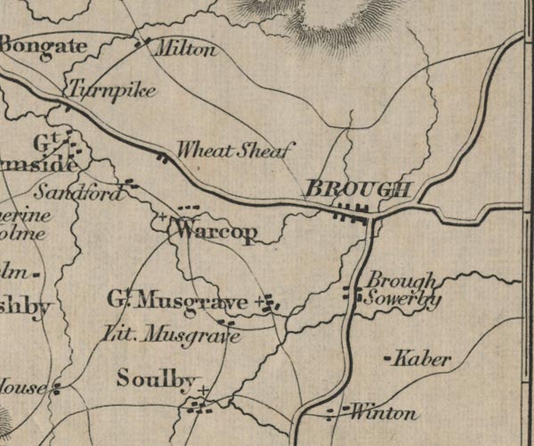
gazetteer links places may or may not be labelled on the map |
||

|
-- Brough Sowerby -- "Brough Sowerby" |
|
|
|
-- Brough -- "BROUGH" |
|
|
|
-- Great Musgrave -- "Gt. Musgrave" |
|
|
|
-- Kaber -- "Kaber" |
|
|
|
-- Little Musgrave -- "Lit. Musgrave" |
|
|
|
-- Bowes to Appleby |
|
|
|
-- Sandford -- "Sandford" |
|
|
|
-- Warcop -- "Warcop" |
|
|
|
-- Wheat Sheaf -- "Wheat Sheaf" |
|
|
civil parishes The area roughly includes parts of parishes:- Brough Sowerby Asby Ormside Stainmore Winton Musgrave Warcop Soulby Kaber Crosby Garrett Murton Helbeck Hartley Kirkby Stephen Brough |
||
|
|
||
|
|
Lakes Guides menu. | |